

Posts in category 'Great Oregon Hikes'
Subscribe and receive email notifications of new blog posts.
 RSS Feed
20
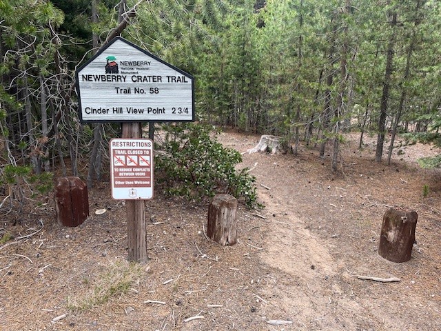
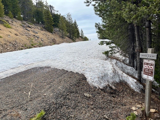
Cinder Hill in Newberry Crater National Monument is a Great Early Hike
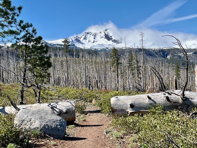
Newberry Crater National Monument is Hikeable Now
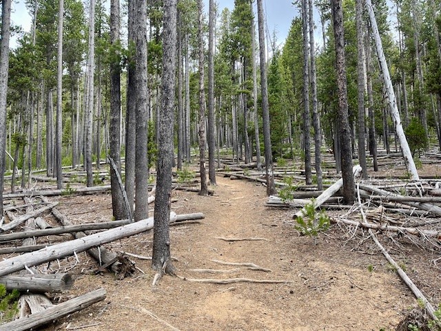
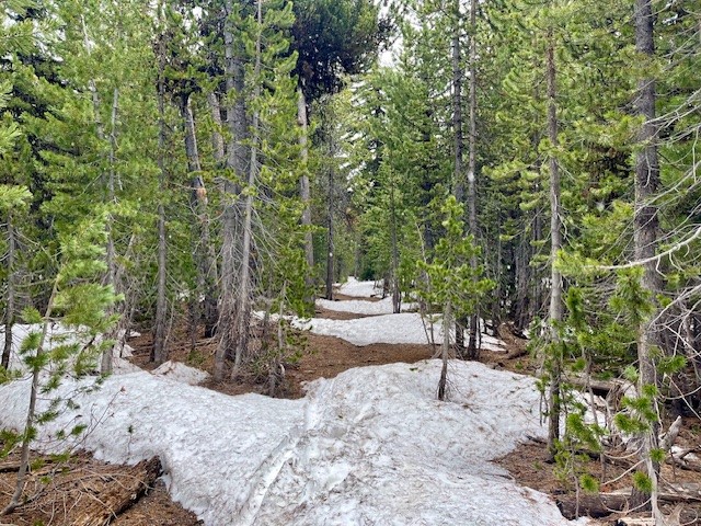
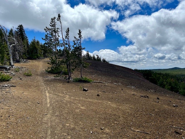
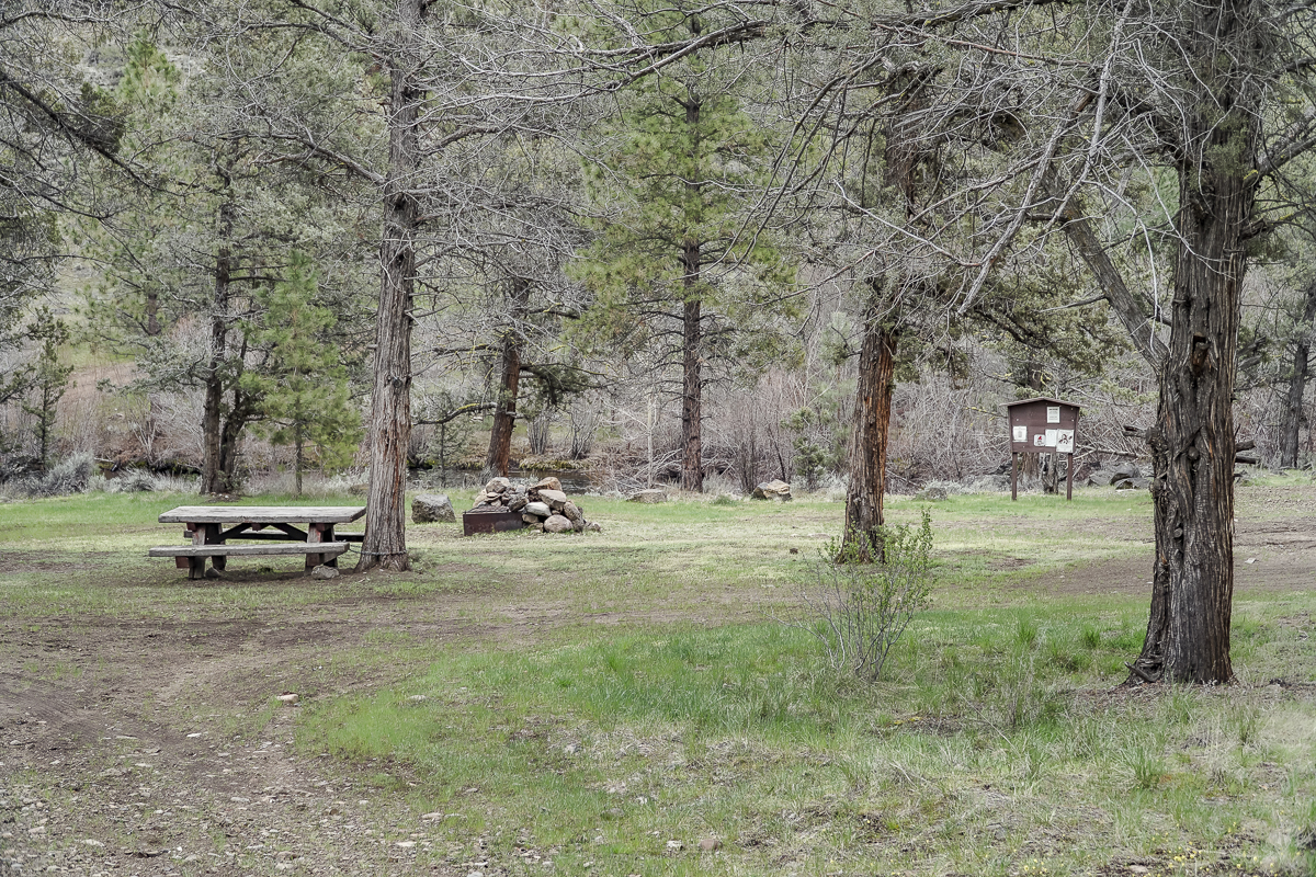
While waiting for the snow to melt from the higher elevations of the Cascade Mountains, people looking for a Central Oregon hike with mountain views can consider Newberry Crater National Monument. Besides the well-known Paulina Falls, Obsidian Trail, the hike to Paulina Peak, and the various treks around both Paulina and East Lake, there is the relatively little known hike starting at the Cinder Hill campground at the end of the road by East Lake up to the Crater Rim and then to the Cinder Hill viewpoint. Although not the longest hike, there is close to 1000 feet elevation gain over two miles and then the relatively easy 3/4 mile hike along the Crater Rim trail to the view point. The hike from the campground to the rim is not difficult due to multiple switch backs and a gradual incline. The trail is well maintained and at the rim hikers may have to compete with people on mountain bikes to reach the view point.On June 15, 2024, the weather was cool with the temperature in the thirties at 9 am. The hike to the rim had some light snow as well as older snow patches left over from winter to traverse. At the view point, although very beautiful with views of East Lake, Paulina Peak and Paulina Lake, the wind was blowing and the wind chill was well below freezing. Hikers didn't last long admiring the setting.
 |
 |
 |
 |
5
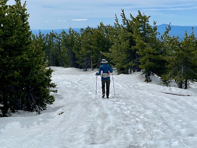
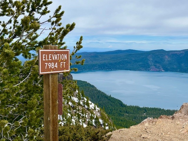
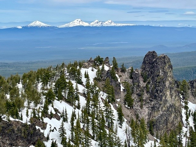
The Road to Paulina Peak in Newberry Crater is Open for Hikers Spring 2024
The Paulina Peak Road Has Snow But it is Melting Fast
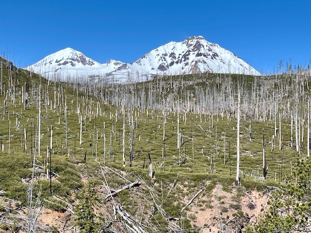
Reports about the trail to the top of Paulina Peak in Newberry Crater National Monument on June 1, 2024 stated that the last mile had a lot of snow. Rather than navigate through this and the abrupt steep drop off the last mile of the trail, hikers could elect to walk the road up to the peak. This road was not yet open for vehicles and had snow patches in the shady areas, but was very much passable by hikers. The last 1/2 mile to the peak on the road had three feet of compacted snow, but with the use of trekking poles, it was easily traversed. The views of the snow capped Cascades and Paulina Lake were splendid from the top as were eastern views toward Fort Rock and the Obsidian Flow. Hiking the road results in 1600 feet of elevation gain to the peak which is just under 8000 feet above sea level, but over a more gradual grade than the trail, making for a longer hike but more easily done. All in all, the total hike by the road is just under 8 miles up and back from the gate off the main road through the monument.
 |
 |
 |
 |
30
Chush Falls is a Fun Hike Just Outside Sisters Oregon
Chush Falls Is Snow Free
One of the earliest spring snow free hikes in Central Oregon's forests is the hike to Chush Falls. The trailhead is located off the road to Three Creeks Lake outside of Sisters several miles down a gravel road and then a short trek up a narrow dirt and rock road. The parking area is small so people wanting to hike the relatively short 2.2 miles to lower Chush Falls should plan on arriving early to get a parking space.
The trail starts in burned forest - the result of the 2017 Milli Fire. However, unlike the experience with earlier hikes, almost all of the burned trees from this fire which have fallen across the path have been cleared which makes the trek to Lower Chush Falls fairly quick. One result of the fire are the views of North/Middle Sister and Broken Top are more unobstructed. And the new young trees are getting taller and starting to be seen through the manzanita and snowbrush.
 |
|
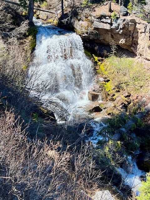
For those who really want to see Lower Chush Falls, there is a steep scramble down the hillside to the base of the falls; the viewpoint at the top is disappointing with tall trees and vegetation obstructing views. However, for those who can tackle the steep hillside, the views of the falls from the base are wonderful.
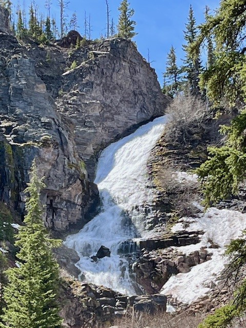
After climbing back up to the viewpoint, hikers can elect to return to the trailhead or continue on to Upper Chush Falls past smaller Cascades Waterfall. This path has not been cleared of fallen trees, so it is much slower to hike over, under and around the tree trunks. However, for those who make it to the trail's end, it is surprising to see the 200 foot waterfall; Lower Chush Falls is 50 feet. The vegetation is thick at the base of Upper Chush Falls with the canyon Whychus Creek flows through steep so it is challenging to really get a great view. The easiest access for photos is up the hillside above the creek over an unsteady rockfall. All in all, for those who make it to Upper Chush Falls, the total hike is 6.5 miles with 961 feet of elevation gain.
 |
 |
21
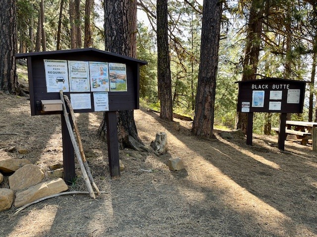
The Trail is Open to the Top of Black Butte
Black Butte Trail is Short but Steep
The trail to the top of Black Butte starts part way up the butte after a drive on a fairly well maintained dirt and gravel road followed by a poorly maintained dirt and rock road. Once you reach the trailhead (complete with stocked toilets), the two mile hike to the top of the butte can be accomplished fairly quickly. Hikers gain over 1500 feet in the two miles, but the Cascade views from Broken Top to Mt Adams can be spectacular on a clear day.
There is limited parking at the Black Butte Trailhead (forest pass required) so hikers are recommended to arrive early to get a spot and to avoid crowds. The hike is very popular with visitors to Black Butte Ranch and and Camp Sherman as well as local year-round residents.
 |
 |
 |
 |
8
Alder Springs is a Little Known Central Oregon Hike
Hike Alder Springs Ideally in Fall or Spring
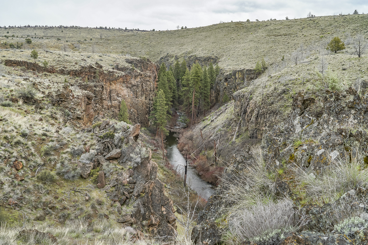
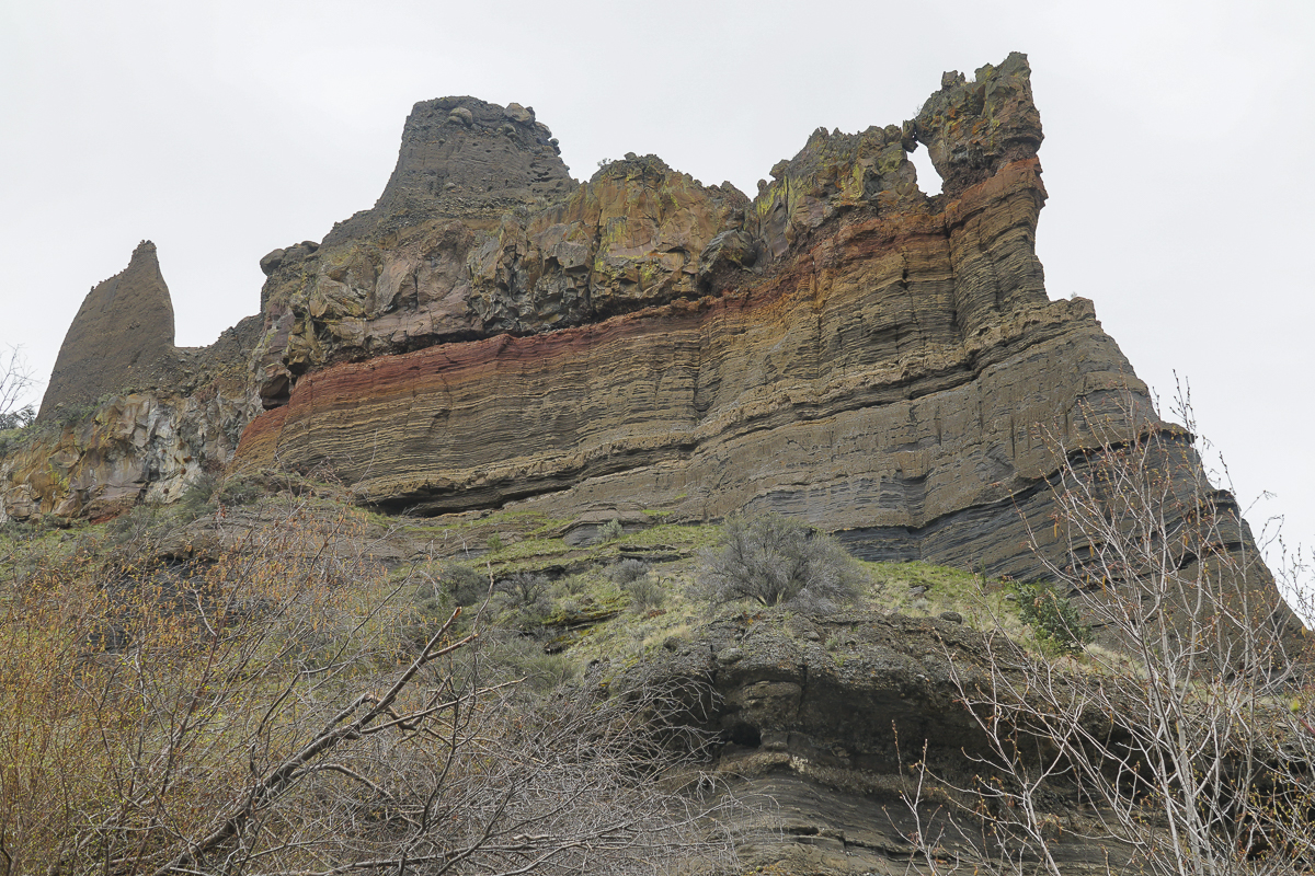
The hike to Alder Springs outside of Sisters limits motorized access from December 1st through March 31st to protect the winter rangeland of the local deer populations. However, access to the trail head is on rough dirt roads for which 4 wheel drive and high vehicle clearance is recommended. Directions to the official trail head can be found on the USDA website. The "unofficial" route involves travel on Locust Street (Camp Polk Road) in Sisters 3.1 miles north from East Cascade Avenue. Take this to Wilt Road, staying on Wilt when the pavement ends 4 miles. Past Rimrock Ranch the road is less maintained. Travel another 2.2 miles until you see a sharp unmarked turnoff to the right onto a rough dirt road. Travel on this past a gate until you reach a picnic area next to Whychus Creek which provides for a water crossing during dry times of the year. There is a beautiful mesa above the crossing and signage for a Native American archaeological site.
 |
 |
The unofficial trail parallels Whychus Creek for over 3.5 miles from the picnic area down the western side of Whychus Canyon eventually dropping to Alder Springs. The trail has some sections which are difficult to locate and other areas where the tract comes close to the canyon rim and the steep drop to the creek. In the summer the exposure with limited trees would make the hike very warm; hikers should be careful to bring plenty of water. Alder Springs is where the "official" trail crosses Whychus Creek and hikers using this trail need to wade across the stream to go any further; in April the water is cold.
 |
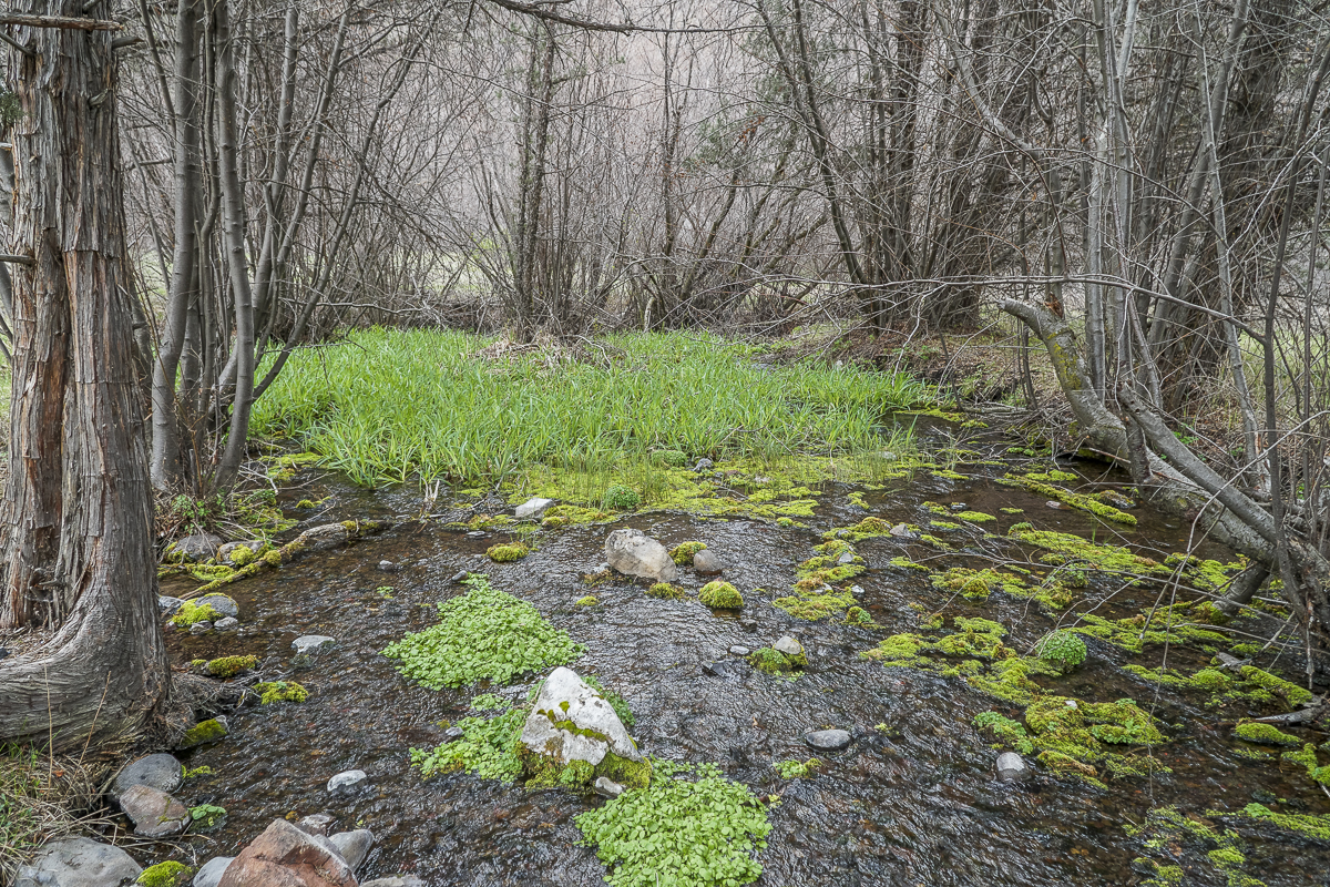 |
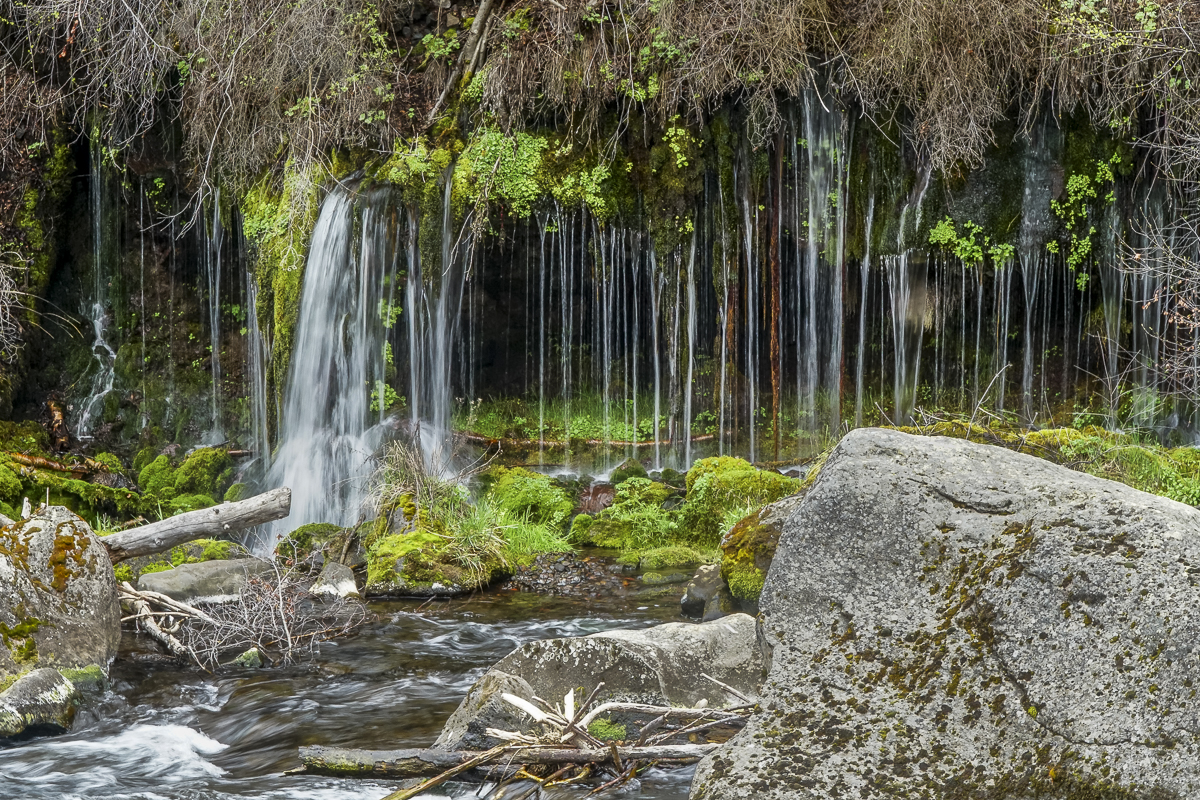
Hikers can enjoy the shade from the many trees and the water bubbling up from rocks at Alder Springs, eventually flowing into Whychus Creek. Or they can continue down Whychus Creek another 1.5 miles to the confluence of the creek with the Deschutes River. This section of the hike has far more vegetation which creates more shade, but also more obstacles to push aside, walk around or over. Close to the confluence is a stone cliff from which a spring flows creating a lovely waterfall. Access to this involves stepping around shrubs and trees to see it and as the vegetation grows later in the spring, many hikers will probably miss the waterfall as it will be hidden from the path. At the confluence, a large rock formation provides the perfect space for lunch and enjoyment of the flowing water and towering rock formations.
 |
 |
All in all, traveling the unofficial route will take more time, but the beauty of the high desert is very much displayed during the hike. Just over 1000 feet of elevation change, 11+ miles, and keeping feet dry make this unofficial route to Alder Springs a wonderful spring or late fall hike.
Privacy Policy / DMCA Notice / ADA Accessibility