

Posts with tag 'Central Oregon Hikes'
Subscribe and receive email notifications of new blog posts.
 RSS Feed
3
Hike Pamelia Lake to Grizzy Mountain 2023
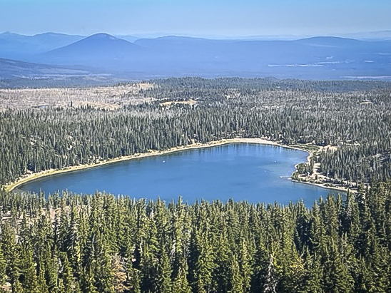
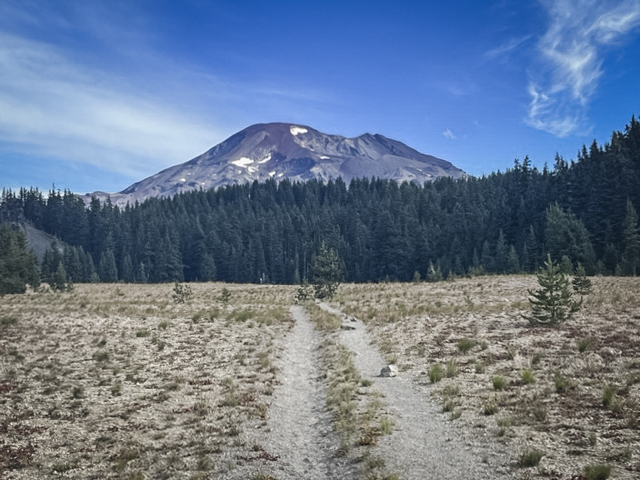
Pamelia Lake is a Very Popular Hike in the Mt Jefferson Wilderness
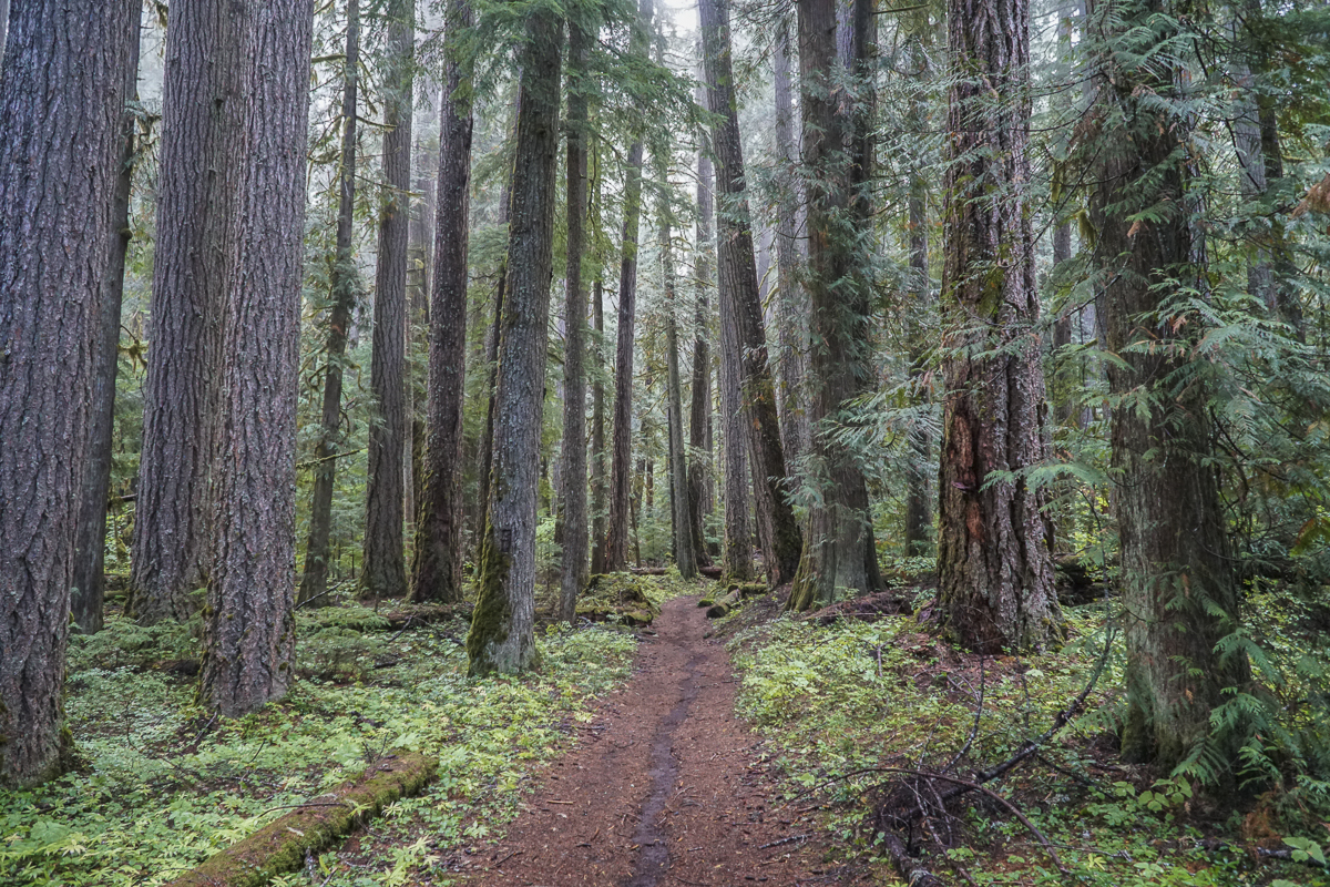
Prior to the recent adoption of hiking passes in the last 3 years, Pamelia Lake was one of a handful of Central Oregon hikes requiring a pass to access. This special lake is an easy 2.5 mile hike which gains 550 feet of elevation as it passes through beautiful old growth forest, complete with many rhododendrons which bloom in late spring. Our hike in late September, 2023, included some views of fall color in sunny spaces where vine maple grew. We could also see areas where the 2006 flood from Mt Jefferson's Milk Creek Glacier wiped out portions of the trail and lovely moss covered forest floor. Plant life is returning and the area should eventually fully recover.
 |
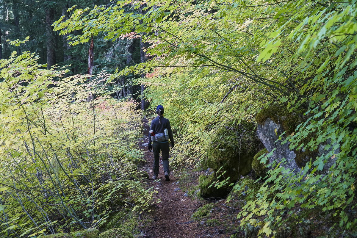 |
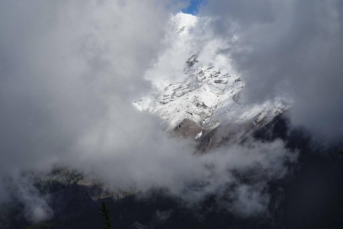
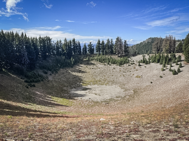
Past the lake, the trail steepens for those planning on summiting Grizzly Mountain. Although over 2200 feet is gained, the path is well graded and doesn't feel as steep as other hikes we have taken in the past. It is another 3.3 miles to reach the top, the entire way in forest with a great viewpoint break roughly .7 miles from the summit. On a clear day, fabulous views of Mt Jefferson should be visible. For us, however, it was cloudy and while peek-a-boo views of Mt Jefferson appeared as the clouds moved, we never saw the entire mountain at once. However, the top of Grizzly Mountain was a great place for a lunch break before we returned back the way we came, enjoying again the hike through the forest with portions of the trail next to lovely Pamelia Creek. Our entire hike was 11.66 miles with 2739 feet of elevation gain. We hope to return next spring to see the rhododendrons in bloom.
 |
 |
22
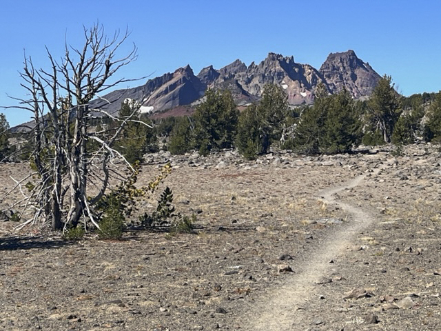
Hike to No Name Lake Via Tam McArthur Rim
Hike Tam McArthur Rim to Broken Top For a Different Approach to No Name Lake
Each year we hike to Broken Top from different trailheads, often arriving at our final destination at No Name Lake, the beautiful glacial aqua blue lake located on the eastern edge of the mountain. One of our favorite hikes includes first a trek to Tam McArthur Rim overlooking Three Creeks Lake outside of Sisters which in itself can be the destination for many. For us, this extended hike passes Tam McArthur Rim on the well marked but "not maintained" trail to Broken Hand and then to the rim overlooking No Name Lake. The total trip for us includes a side trip north of Broken Hand into the safer, but longer path around Broken Hand and then up to the rim. This hike exceeds 10 miles and 2000 feet of elevation gain, but is well worth the trip for the beauty of close views of all Three Sisters and Broken Top. At one point on the hike, views from Mt. Bachelor to Mt Hood are visible - 9 total Cascade Peaks.
 |
 |
 |
 |
8
Bend Premier Real Estate | September 2023 Newsletter
What's in the September 2023 Bend Premier Real Estate Newsletter?
- Bend Real Estate Sales Cooling
- Air Fryer Apple Fritters
- 9 Things You Should Do to Your Home Before Fall Starts
- Crater Rim Trail at Newberry National Volcanic Monument
- Homeowners Have a Lot of Equity Right Now
5
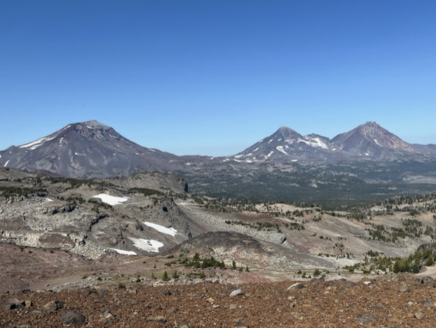
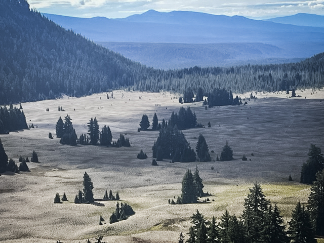
Wickiup Plains in the Three Sisters Wilderness Offers Unexpected Surprises
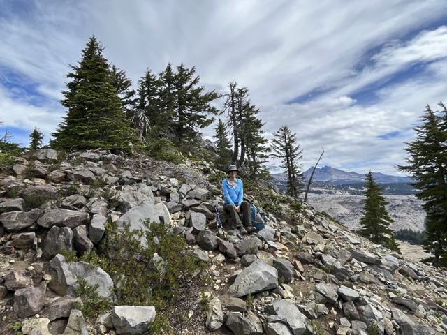
We have hiked Wickiup Plains in the past, reaching it after first traveling to Sisters Mirror Lake. Another time we hiked through it on our way to Moraine Lake, a wonderful destination or pass through for those hiking to the top of South Sister. Last Saturday we had a break from the smokey air resulting from several forest fires and we capitalized on hiking to Wickiup Plains once again, this time with new plans. These included climbing two hills overlooking Wickiup Plains - Le Conte Crater and The Wife.
 |
 |
Wickiup Plain is mostly a cinder plateau through which the Pacific Crest Trail passes. However, there are fabulous views of the western flanks of South Sister and Broken Top from the plain that many never see. The trip up to the top of Le Conte Crater had a social trail we found which is not on any map and was worth the hike.
 |
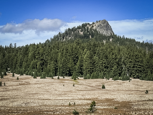 |
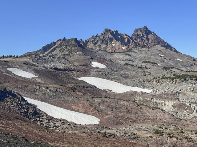
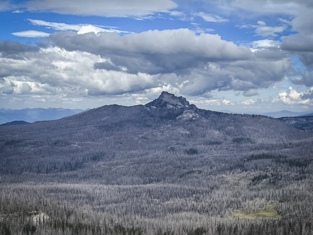
The Wife, however, was a difference experience. Many have heard of The Three Sisters and Mt Bachelor, four of the well recognized Cascade Mountain Peaks in Oregon. But besides the Sisters (also named Faith, Hope and Charity), there is Little Brother, The Husband and The Wife. Little Brother is part of the Three Sisters, its flank abutting Middle and North Sister. However, The Husband and The Wife stand alone without much recognition. The Wife is next to the Wickiup Plains and after coming down from Le Conte Crater, we trekked across the plains to The Wife. Rising over 7000 feet above sea level, The Wife is still drawfed by South Sister, which is the third highest peak in Oregon at over 10,300 feet. But having hiked both now, I can honestly say that the steepness of The Wife felt greater than what we experienced on South Sister. One review said the last 1/2 mile to the top of The Wife was at a 65 degree grade. But unlike South Sister, this grade is on small pumice stones in which tufts of fescue and other vegetation live. South Sister is nothing but pumice rocks and scree at the top. There was no trail to the top of The Wife whereas there is a clearly defined path to the top of South Sister. But the hike up The Wife was far shorter than that to summit South Sister.
 |
 |
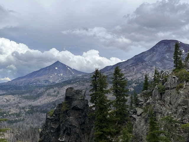
Despite the steepness of the hike up to the the peak of The Wife, the slopes to the north and west of The Wife are dangerously steep and we were careful at the top to avoid getting too close. However, the views were amazing. The Husband was to the north and South and Middle Sister were to the northeast. The air was clear despite recent rain, which probably helped immensely with our forest fires.
 |
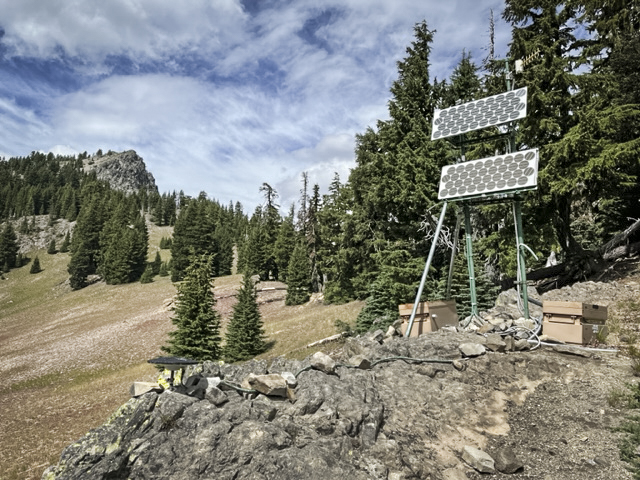 |
When we climbed down from the top of The Wife, we checked out what we think is a set up by the US Geological Survey to measure uplifts in the ground around South Sister. We have heard for years about the growing bulge near South Sister which is believed to be caused by build up of magna under the earth. We think the machinery we found is part of what is used to measure this. Hopefully we won't have another Mt. St. Helens in the near future!
29
Crater Rim Trail at Newberry National Volcanic Monument Worth the Trip
Crater Rim Trail Lightly Traveled
Newberry Crater, including Paulina Peak and Paulina Falls, are often our go-to hikes when the weather doesn't cooperate in exploring the Cascades. At a lower elevation, we can often hike this area well into early winter when snow stops our adventures in the higher mountain regions. And its location, between Bend and La Pine, is an easy drive from home.
Last Saturday, we ventured into Newberry Crater to avoid the choking smoke much of Central Oregon has been experiencing from the Bedrock fire and now Lookout and Petes Lake fires as well. We were fortunate that the air stayed relatively clear during our day there and we could enjoy a great hike.
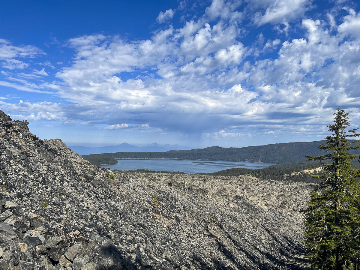
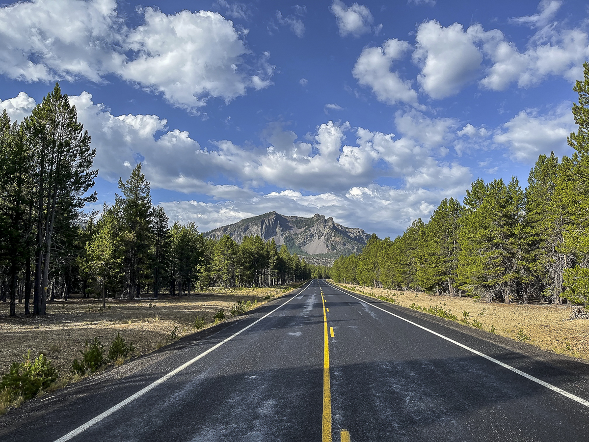 We found a hike we had never done before last Saturday. All Trails named it "Lost Lake to Crater Rim Trail" and it was a loop. The suggestion was to park at the Obsidian Flow parking lot, but we drove further down the road to an access point off the main road about a mile past.
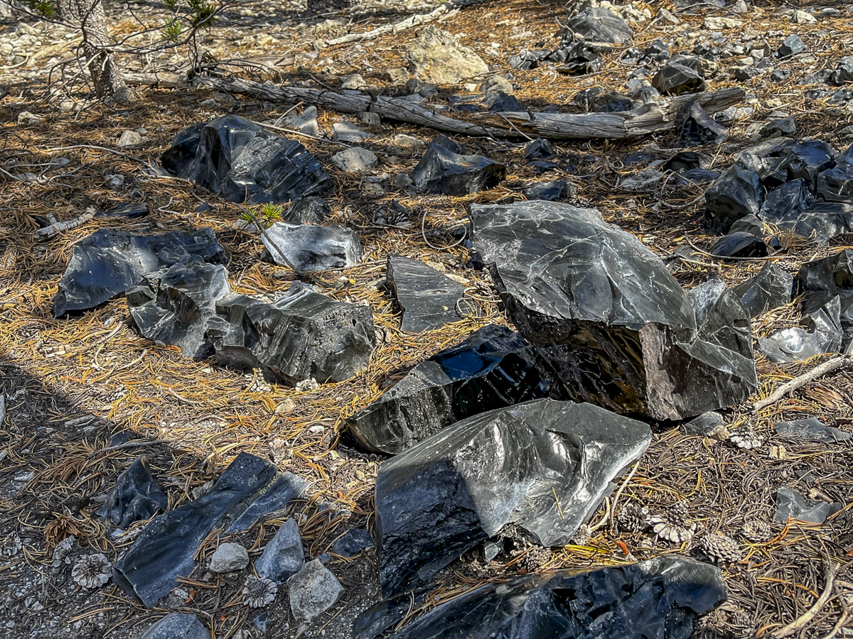
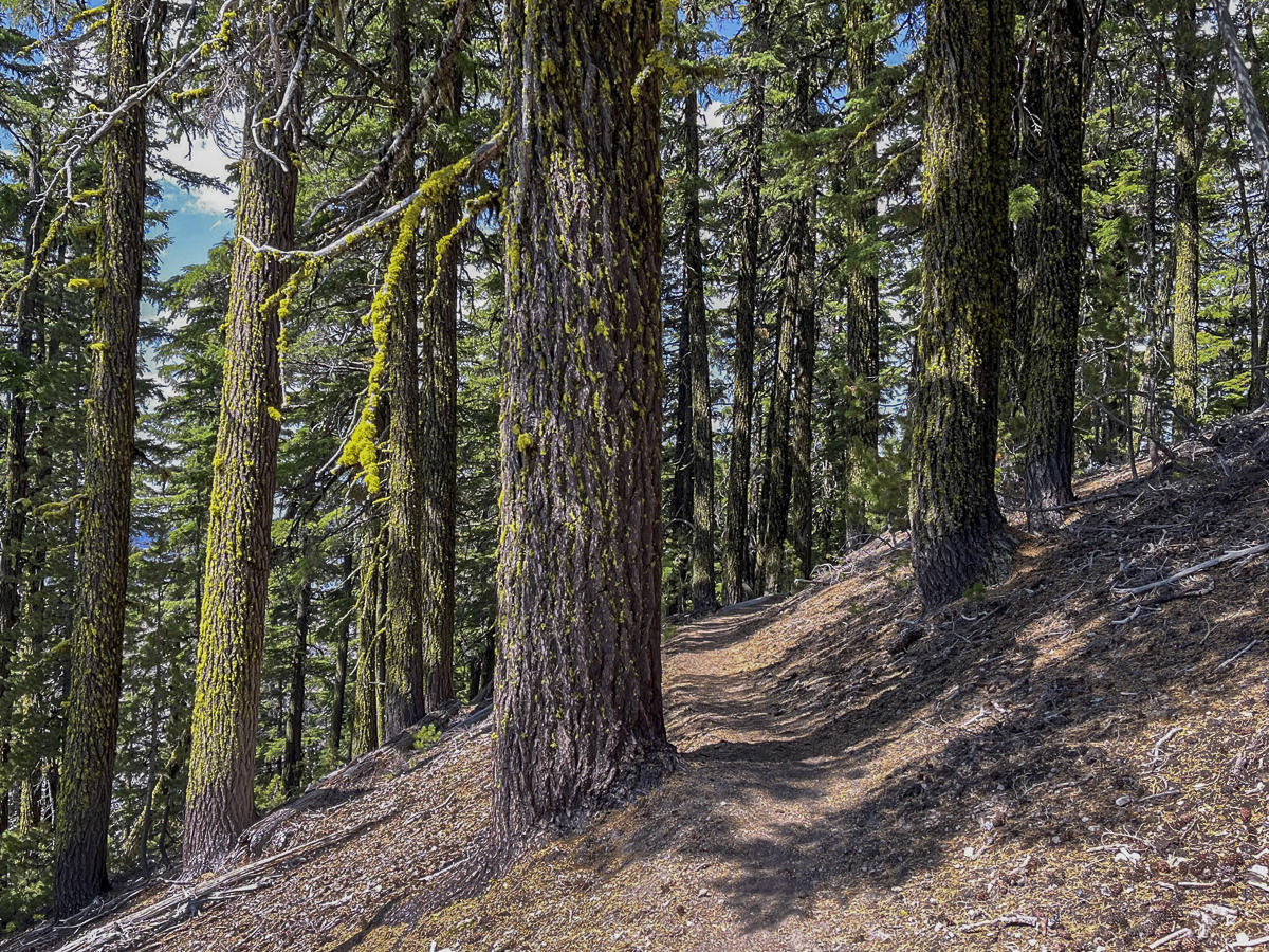
Our initial hike was through a lodgepole pine forest, but as we got further away from the road, we began to gain elevation and the trail got closer to the obsidian flow. We saw larger obsidian stones on each side of the trail as the hike got gradually steeper.
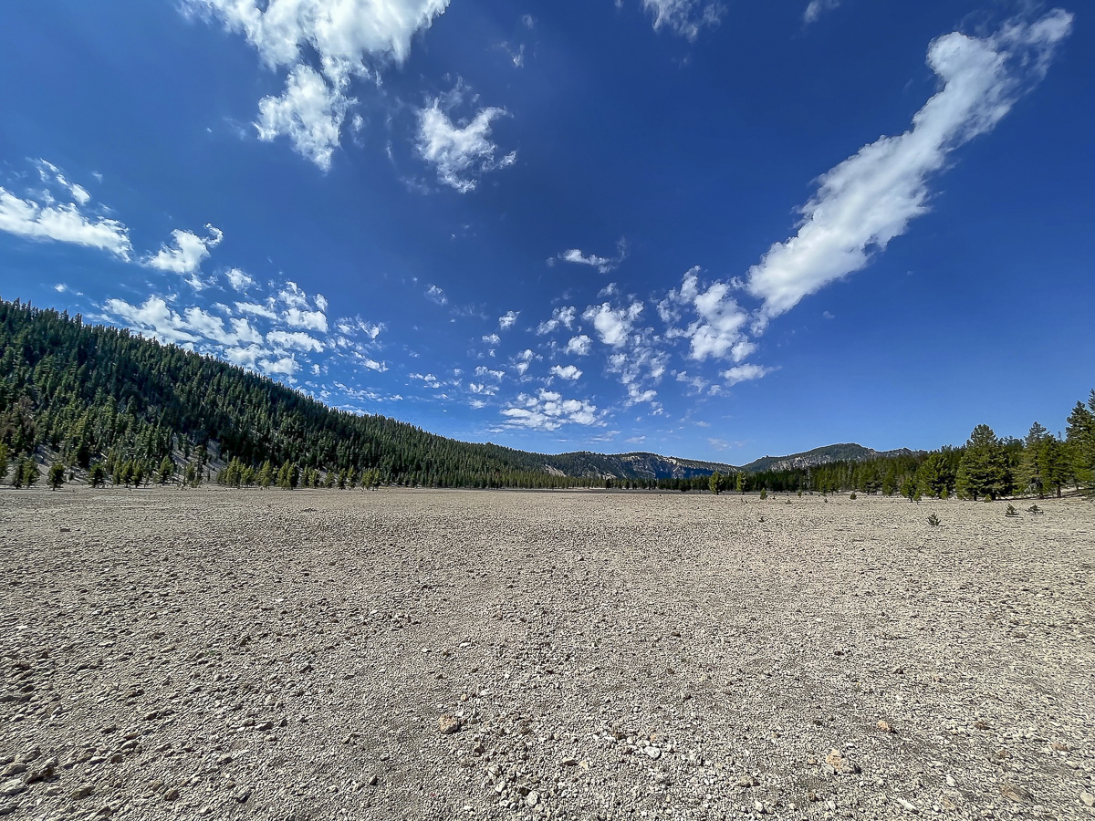
Eventually we reached the Crater Rim Trail. This trail circles Newberry Crater fully and is over 20 miles in length. We didn't want to take this hike today, but rather followed the route we downloaded. This involved a section of Crater Rim, and then a loop which dropped into a canyon that came up by Pumice Flat and rejoined our original trail. This seemed a bit short for us, so we went back up the loop and then hiked toward Paulina Peak, not fully reaching it but found a terrific lunch spot to enjoy the views of Paulina Lake. We then returned back the way we came. The entire hike was just over 13 miles with 2350 feet of elevation gain. We only saw 4 people during the entire hike - all of them riding mountain bikes.
 |
 |
 |
 |
Privacy Policy / DMCA Notice / ADA Accessibility