

Posts with tag 'Central Oregon Hikes'
Subscribe and receive email notifications of new blog posts.
 RSS Feed
14
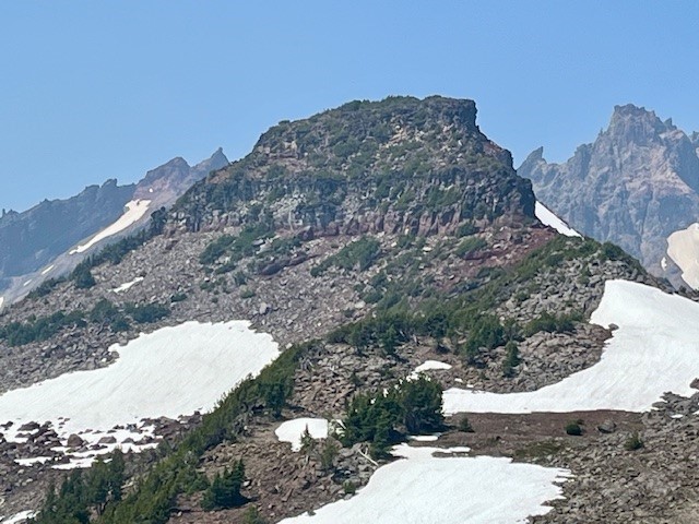
Black Crater is More About the Destination Than the Journey
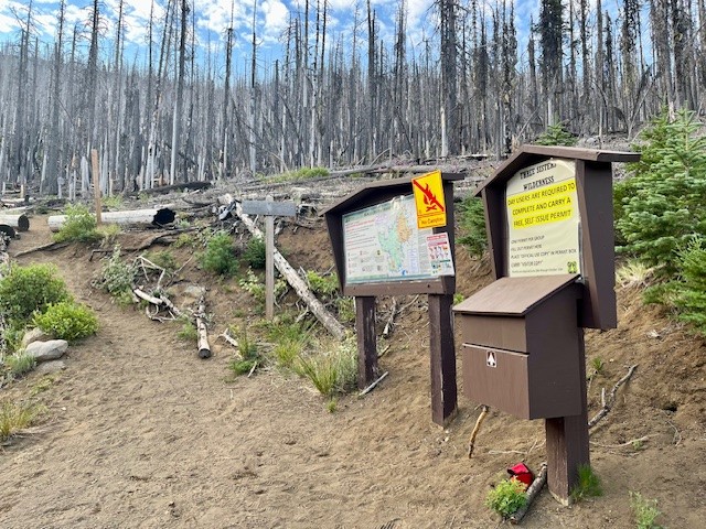
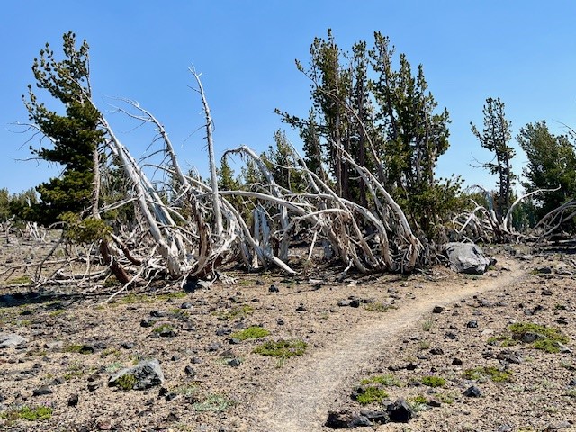
Black Crater Trailhead is Located off McKenzie Hwy 242
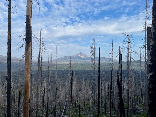
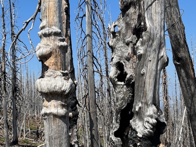
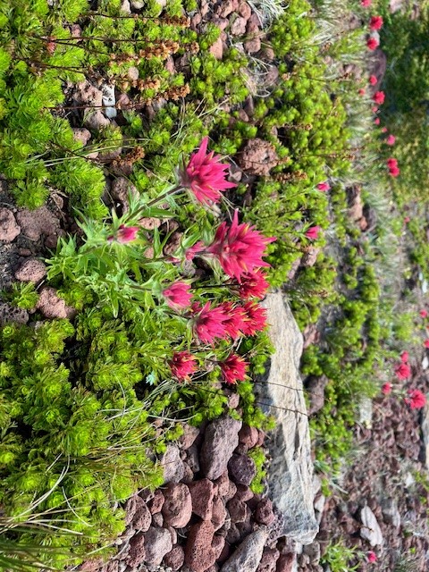
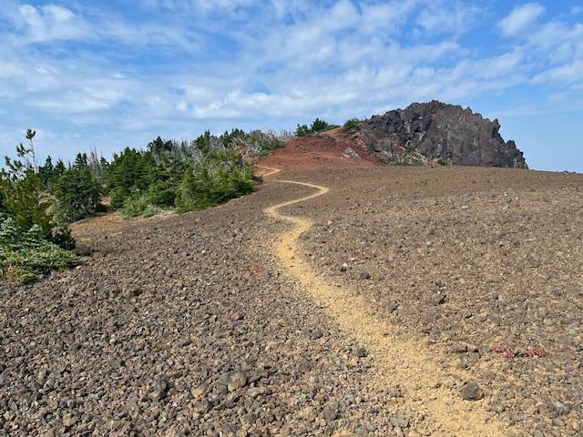
For those wanting a relatively short hike which provides for a lot of elevation gain, Black Crater is one of the best. Located off McKenzie Hwy 242, the hike is limited to the summer season when McKenzie Hwy opens each year. Unfortunately, the 2017 Milli fire burned a lot of the forest on McKenzie Hwy, and the lower slopes of Black Crater were impacted. In the seven years since the Milli fire, manzanita, certain grasses, some wildflowers, and young trees have begun to grow in the dead landscape, but it will take decades until the cinder cone is entirely forested again. The one advantage of the burned forest is the views toward Mt. Washington are far more visible in the lower elevations than they would have been eight years ago.
 |
 |
 |
 |
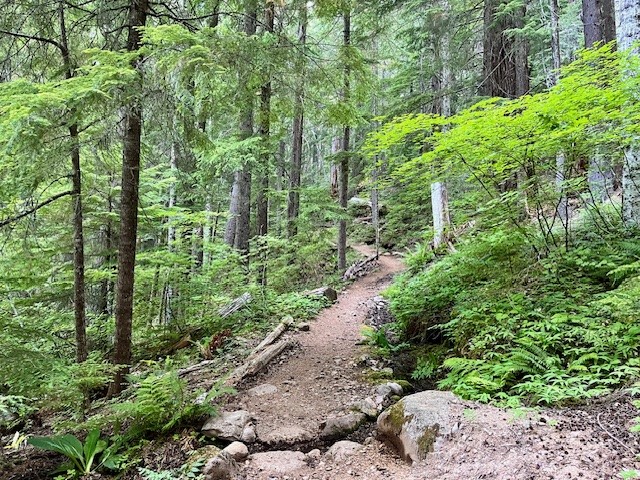
Roughly two and a half miles into the hike, the burned forest is left and the steep path zigzags through mixed forest and cinder fields. And at three and a half miles, hikers reach the top. The views on a clear day towards The Three Sisters, Broken Top, Mt Jefferson, Mt Washington, and all the hills in McKenzie Pass are fabulous. Plus hikers have the satisfaction of having climbed over 2300 feet to reach the top. The hike down goes faster than the up and many can complete the entire hike, without really pushing, in a little over three hours.
 |
 |
1
Hike Cooper Spur on Mt Hood for a Unique Experience
Cooper Spur is the Highest Maintained Trail on Mt Hood
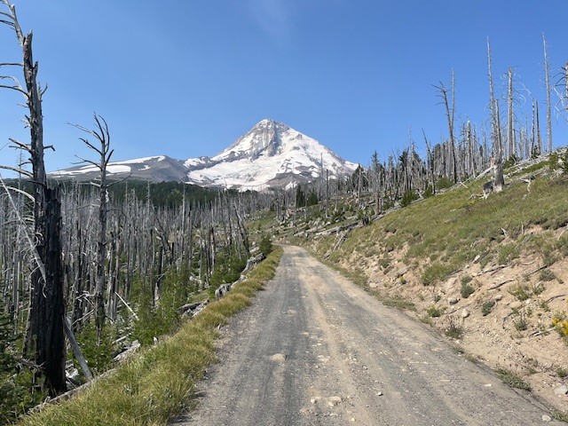
When smoke from forest fires makes hiking in Central Oregon unsafe, one option can be to go north towards Mt Hood. There are times in which air quality is hazardous in Central Oregon and the air is clear in the north part of the state. This was the situation on July 27th. It is a bit of a drive from Bend to Mt Hood (plan on 2.5 hours), but the air was clear mid morning in the Mt. Hood National Forest.
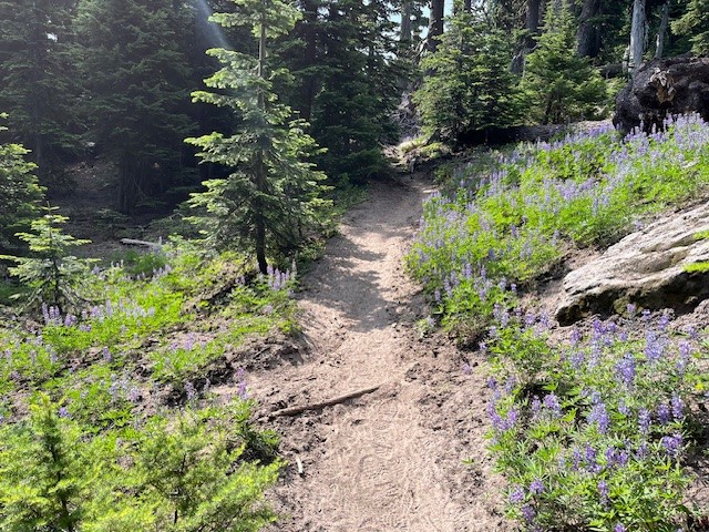
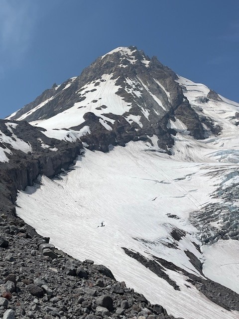
Cooper Spur is located on the northeast flank of Mt. Hood and has multiple ways to hike to it. The hike from the Cooper Spur Trailhead is one of the shorter ways, but it does gain almost 2700 feet of elevation in roughly 3 miles so it is considered a more challenging hike. To access the this trailhead, hikers drive on close to 9 miles of gravel road which has sections of bad potholes and steep drop offs at the end, but it is passable.
 |
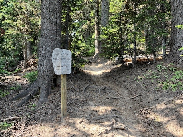 |
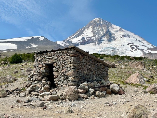
The initial hike takes trekkers through an old growth mountain hemlock forest complete with wildflowers and streams. As hikers climb, they eventually leave the forest and the path takes them through the tumbled rock of the lower sections of the Eliot Glacier moraine. After hiking above this area, hikers find themselves on the windswept, rocky plane under Cooper Spur. A 70 year old rock shelter is located here, the last one of several that once encircled Mt. Hood and acted as resting places for those who attempted the 41 mile Timberline Trail that still attracts many backpackers today. It is amazing to see this shelter still standing, given all the huge boulders that are nearby, the results of numerous avalanches.
 |
 |
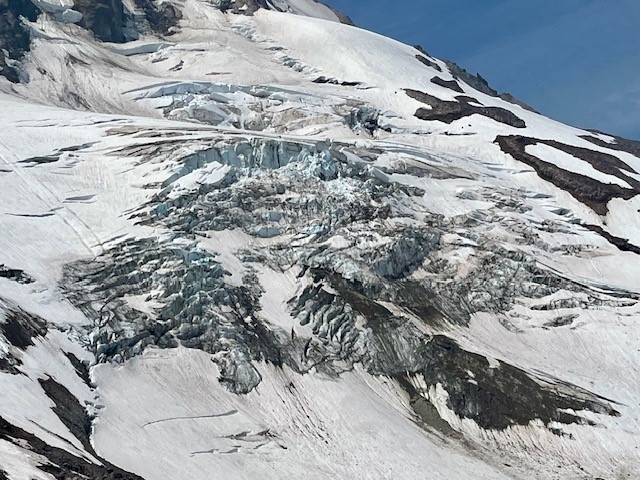
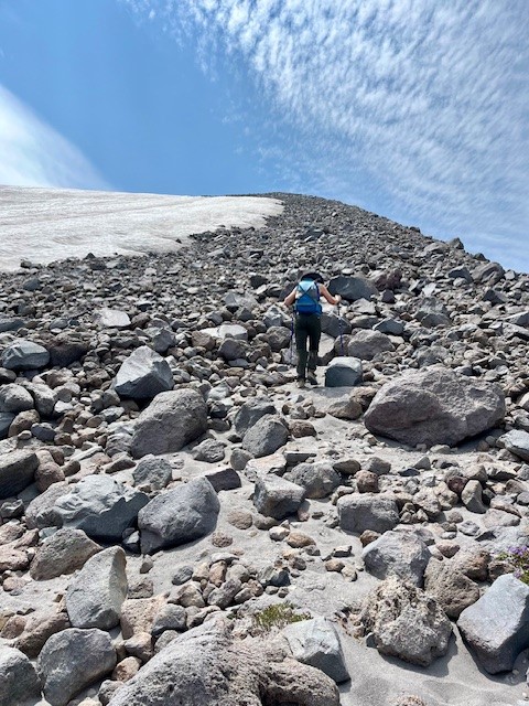
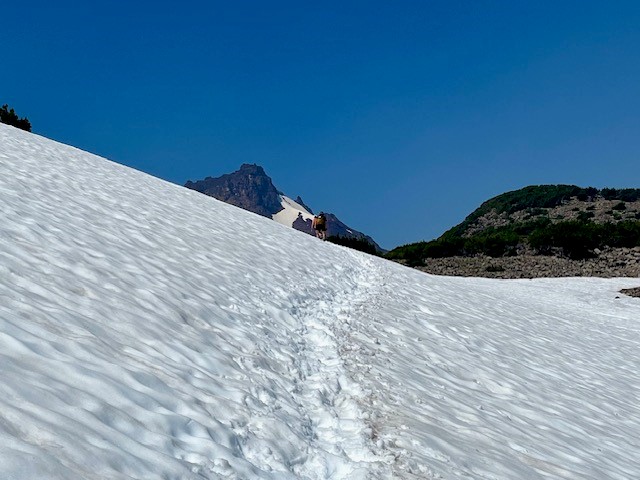
Past the stone shelter, the trail passes through rocky landscape until the actual push up the lower sections of Cooper Spur begins. Switchbacks take hikers up the spur, but near the top a snow field (this was July 27, 2024) creates a barrier that makes summiting the spur challenging. Those who wish to make it to the top need to boulder along the ridge overlooking Eliot Glacier until they reach the summit.
 |
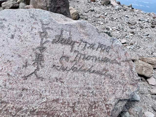 |
Once hikers reach the top of the spur, the views toward the summit are amazing as would be views toward Central Oregon and the Columbia Basin on a clear day. There is a monument stone carved in 1910 from a Japanese hiking party that is interesting to see. If hikers take a quiet break on the summit, they can hear the breaking (calving) of Eliot Glacier as it moves and thaws in the summer heat.
 |
 |
26
Hike Tam McArthur Rim to Broken Top For the Views and Experience
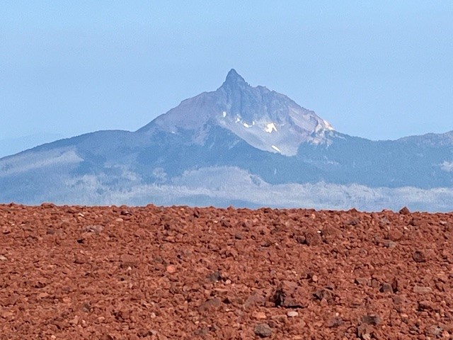
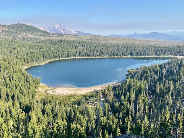
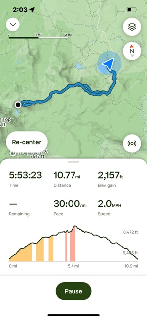
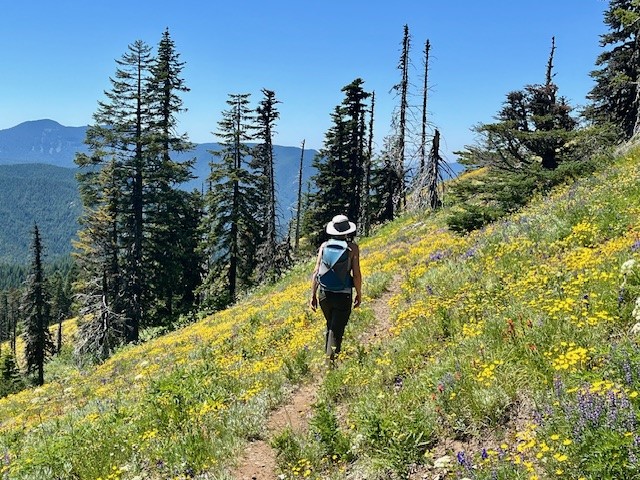
Besides the lake, many will take the 5.3 mile round trip hike (permit required) above the lake to Tam McArthur Rim, gaining over 1200 feet in elevation to reach the rim. Typically the views from this spot are clear from Broken Top and the Three Sisters all the way to Mt. Hood. However, in recent years summer forest fires have added haze and smoke often obstructing the views.
 |
 |
On July 20, 2024, the day started with a slight haze but by the end of the day, the smoke from forest fires settled into the area. However, the hike to Tam McArthur Rim was uneventful with just a handful of people also taking the same trek.
 |
 |
 |
 |
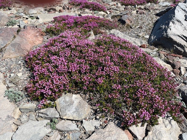
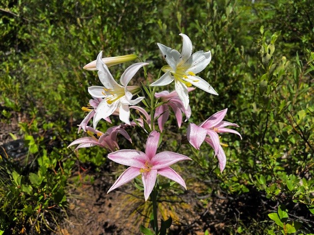
Past Tam McArthur Rim, the unmaintained trail to Broken Hand and Broken Top had abundant wildflowers for this alpine area as well as heavier snow patches than experienced in past years. The approach to Broken Hand involves scrambling over rocks and climbing several cinder ridges before reaching this rugged, rocky prominence. To pass it this July involved either detouring around the rocky base, hiking over snow fields, or trekking directly over snow on Broken Hand's westside. Either way people needed to be careful to avoid falling and sliding down the snowy hill. The majority of people appeared to be going directly over the snowy side of Broken Hand.
 |
 |
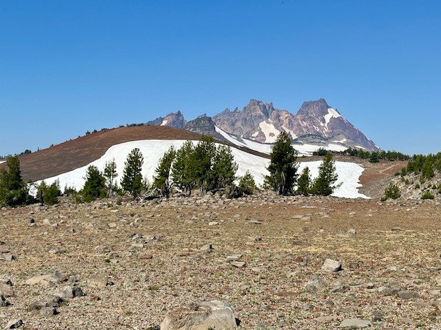
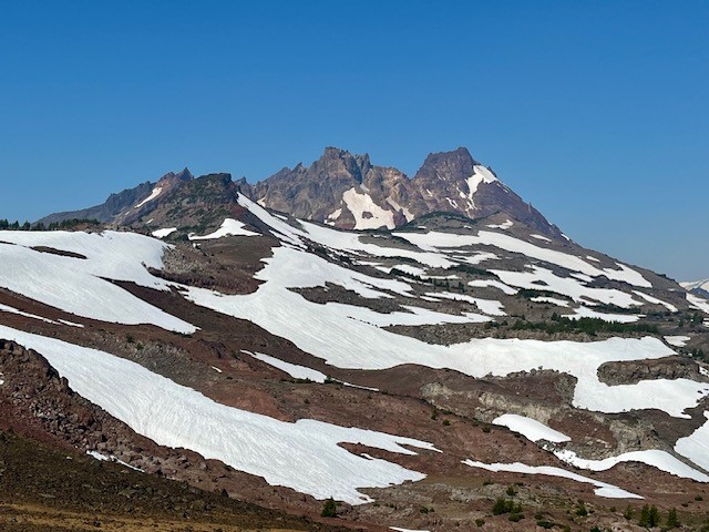
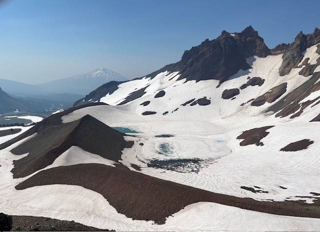
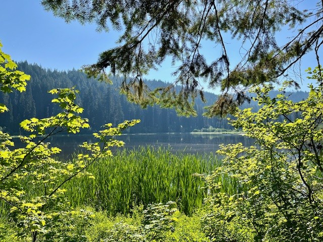
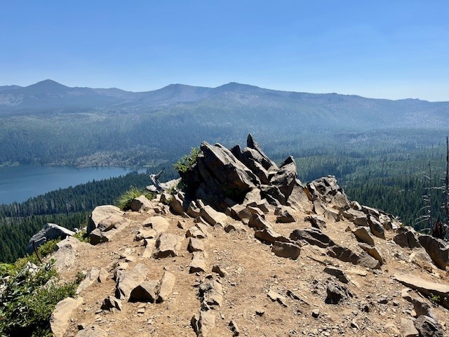
Past Broken Hand, there is a hill to climb to reach a fabulous view point. From here, the cragged top and colorful flanks of Broken Top are very visible (along with ski tracks from recent, ambitious past visitors who must have either rope climbed to the top of Broken Top and rappelled down or else made their was up the very steep side of the mountain to the top of the snow patch and skied down to the lake) as well as snow and ice covered No Name Lake. Besides Broken Top, the Three Sisters are very big and impressive from this view point and Mt. Bachelor and Tumalo Mountain visible in the hazy distance. The hike back to the trail head goes fairly fast as it is mostly downhill. All in all, the entire hike is under eleven miles and about 2150 feet of elevation gain.
 |
 |
17
Marion Mountain Hike has Lakes, Mountains and Waterfalls
Marion Mountain Hike has it All in Central Oregon
Past Santiam Pass off Hwy 22 over the bridge at Marion Forks is the turn off to the trail head for Marion Lake/Mountain. Hikers have to travel over 5 miles down a paved, then decent gravel road to the trail head and must present a forest pass to hike the trail. Once past the trail head, hikers climb two miles through old growth forest until they reach Lake Ann, accessing the lake shore over a stone covered creek which flows from the lake. The trail skirts the end of Lake Ann and after a half a mile, reaches Marion Lake.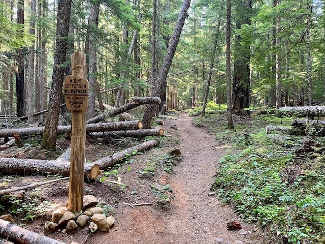 |
 |
 |
 |
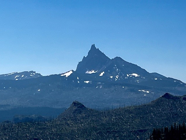
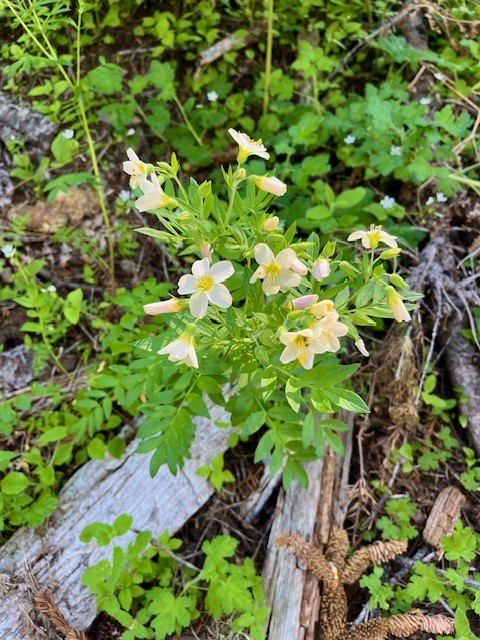
The trail splits here. Hikers wishing to take the path next to Marion Lake can do so, and others wishing to bypass the lake and travel on to either Marion Falls or Marion Mountain can do that. The path to Marion Mountain connects again with the path next to the lake, but past the lake the path steepens as hikers gain elevation hiking up Marion Mountain. There are scattered open areas (complete with the remnants of forest fires) and forested areas as the remaining miles to the top of the mountain are climbed. At the top of the mountain the views of Mt Jefferson and Three Fingered Jack are wonderful. The viewpoint is on a narrow rocky outcrop with steep drop-offs on each side. On July 13, 2024, butterflies and summer wildflowers were abundant.
 |
 |
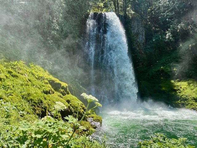
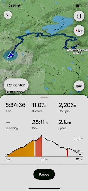
On the hike back to the trail head, an unmarked path near the Marion Lake junction leads to Marion Falls. Hikers to the falls have to traverse over and around downed trees and a very steep path to get to Marion Falls. However, seeing the falls up close is wonderful. There is another steeper path to access the lower falls which adventurous hikers can take. The negative of seeing the falls up close is the steep path - which has to be climbed to get out and back to the main path back to the trail head. All in all, the total distance traveled was over 11 miles with over 2200 feet of elevation gain.
 |
 |
11
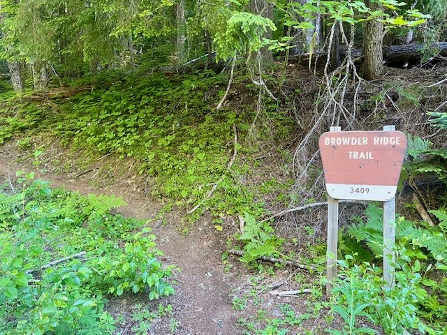
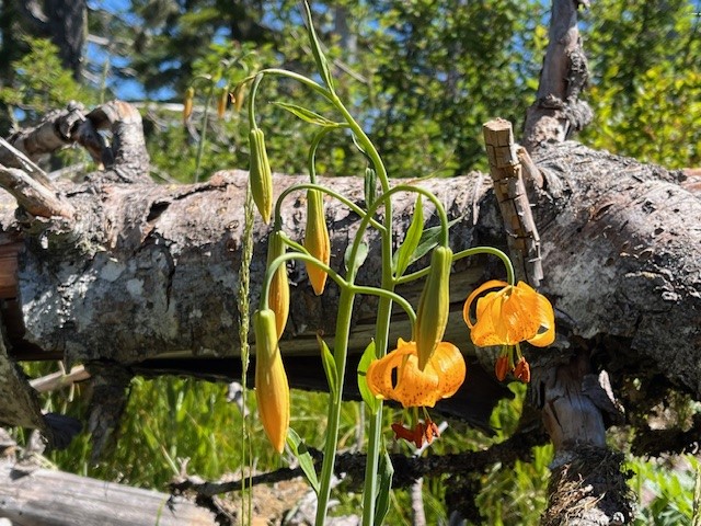
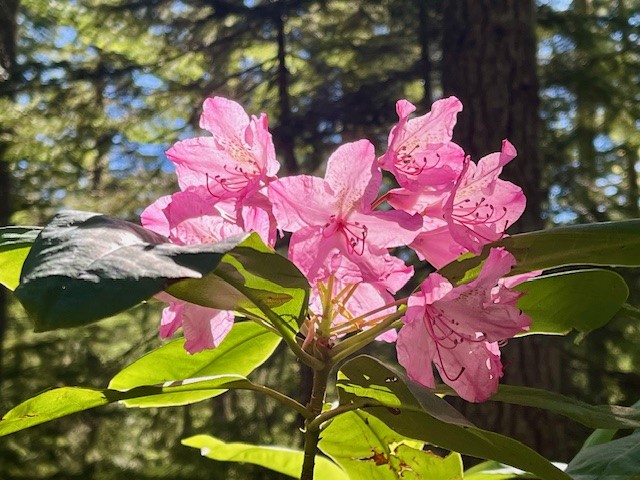
Browder Ridge is a Little Known Hike with Amazing Wildflowers
Browder Ridge Has Outstanding Cascade and Wildflower Views
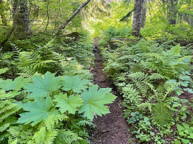
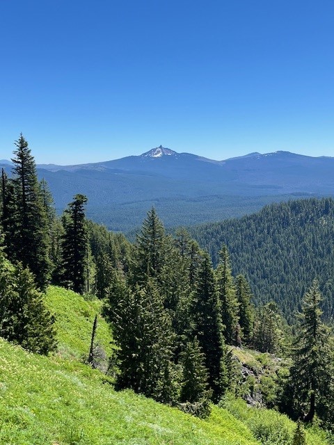
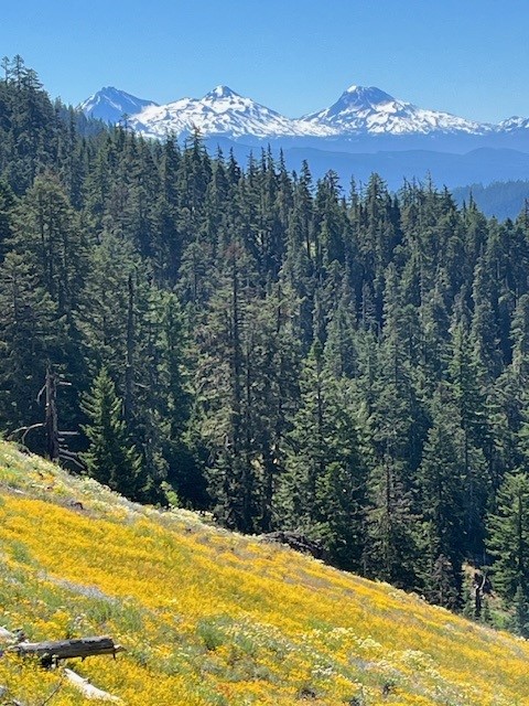
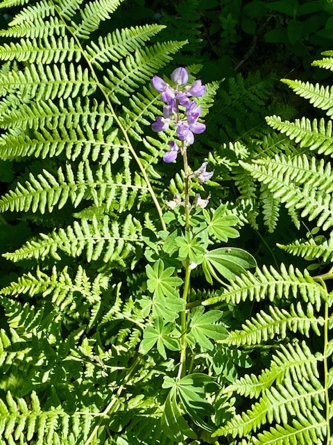
The little known Browder Ridge hike is an alternative to the well known Iron Mountain hike many take during wildflower season. Iron Mountain is located off Hwy 20 near Tombstone Summit. The easiest access to Browder Ridge Trail is near the Iron Mountain trailhead a few miles up paved forest service road 15.The first few miles of the hike are in forested old growth with a lot of shade; ferns, rhododendrons, and various shade-loving ground cover plants are evident in this section of the hike.
 |
 |
 |
 |
 |
 |
 |
 |
 |
 |
Privacy Policy / DMCA Notice / ADA Accessibility