

Posts with tag 'Places to See in Central Oregon'
Tara & Kyle Wieche Blog
 RSS Feed
Subscribe and receive email notifications of new blog posts.
RSS Feed
Bend Makes Another List | 3 Posts
Bend Oregon Real Estate Trends | 65 Posts
Bend Premier Real Estate Listings | 1 Posts
Bend Premier Real Estate News | 25 Posts
Bend Real Estate General Information | 134 Posts
Bend's Best Bites | 1 Posts
Central Oregon Real Estate | 23 Posts
Central Oregon Real Estate Market Trends | 9 Posts
Fun Real Estate Facts | 1 Posts
Great Oregon Hikes | 57 Posts
Happenings in Bend | 7 Posts
Luxury Real Estate | 15 Posts
Neighborhoods to See in Bend Oregon | 8 Posts
Newsletters | 36 Posts
Places to See in Central Oregon | 19 Posts
Redmond Oregon Real Estate Trends | 7 Posts
Uncategorized | 4 Posts
Why We Love Central Oregon | 19 Posts
July
7
7
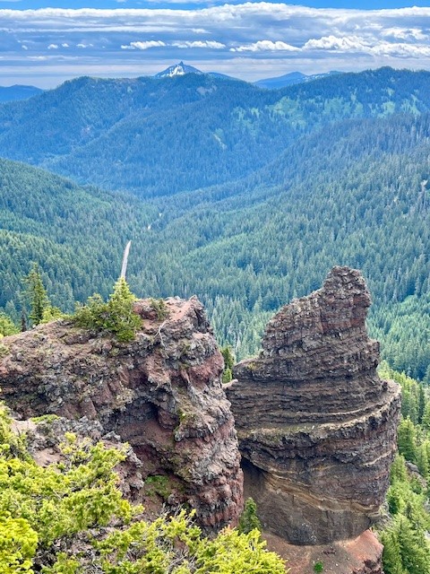
Be Surprised at the End of Maxwell Butte Trail
Maxwell Butte is a 10 Mile Hike in the Willamette National Forest
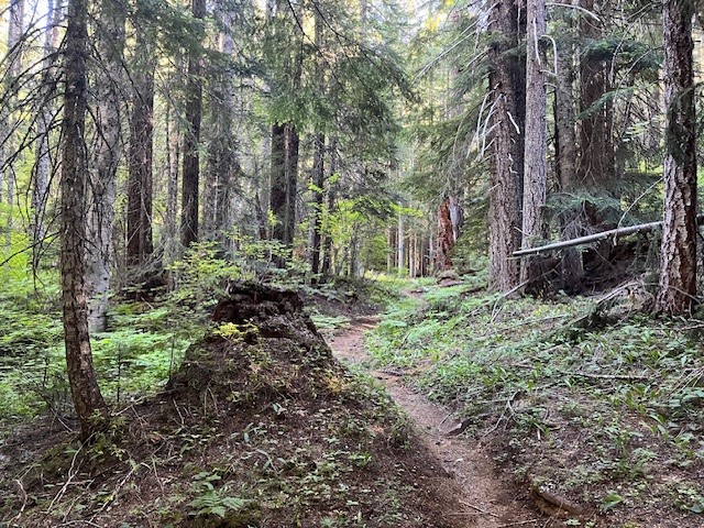
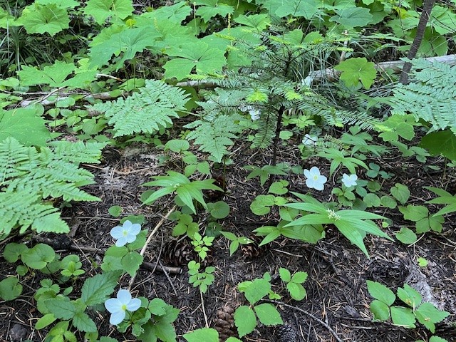
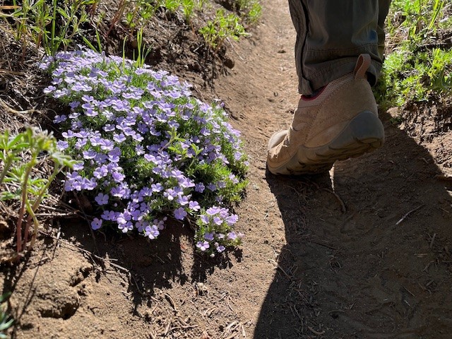
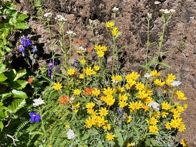
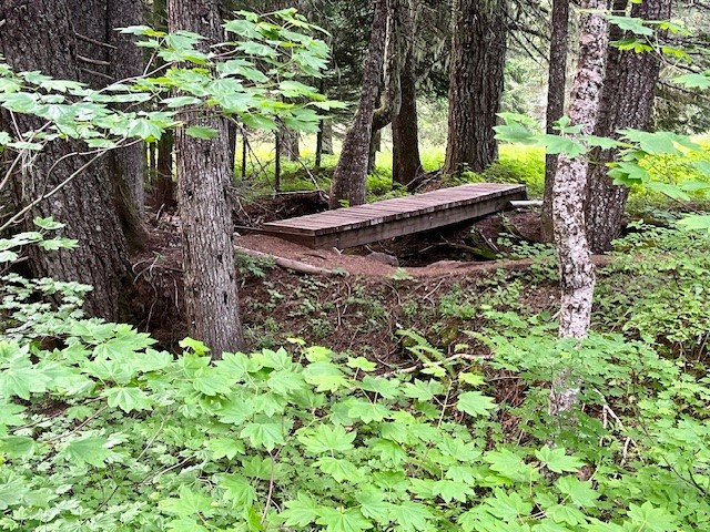
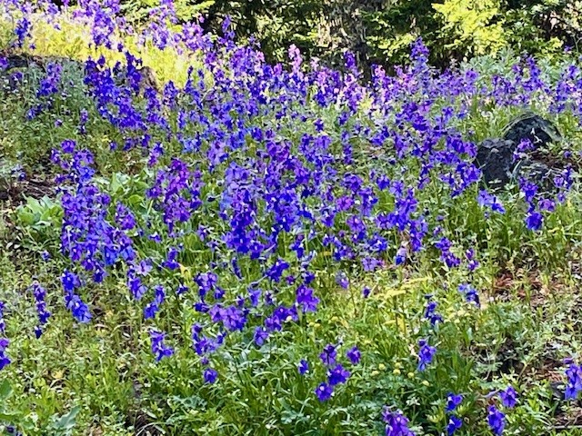
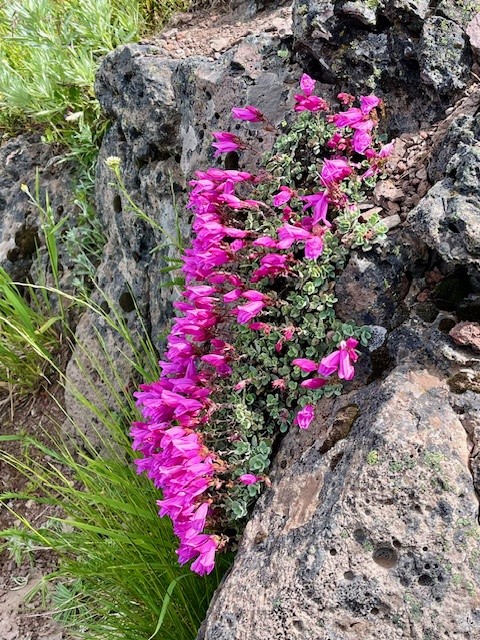
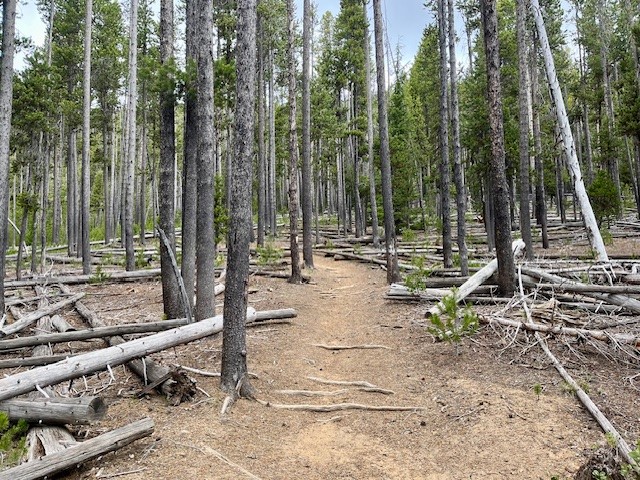
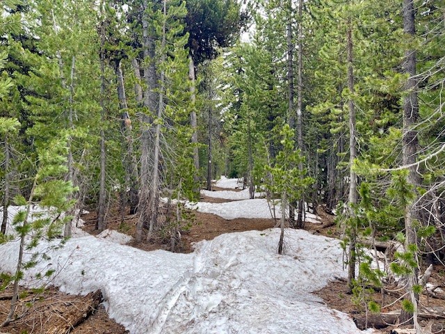
The 4th of July 2024 was a clear and beautiful day to hike in the forests of Oregon's Cascades. Despite a few mosquitoes in the early hours of the hike, the well marked trail to the top of Maxwell Butte was cleared of fallen trees and only had a few snow patches once the trek up the butte itself began. However, the walk through the woods was lovely with many shade-loving wildflowers blooming and no one else seen.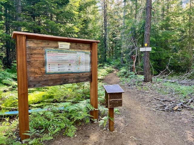 |
 |
 |
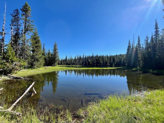 |
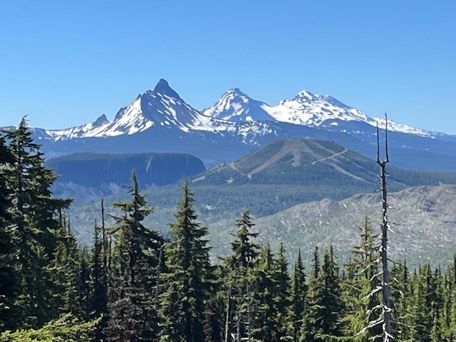
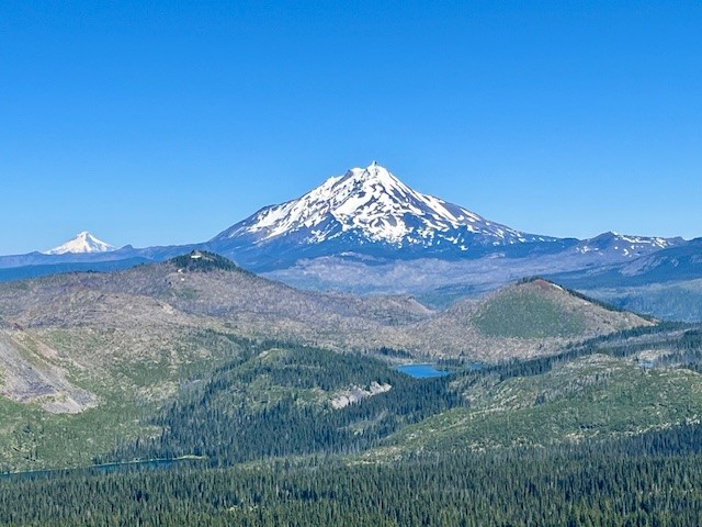
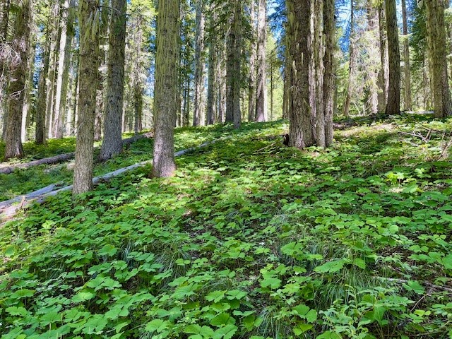
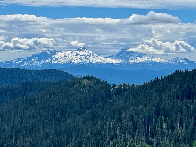
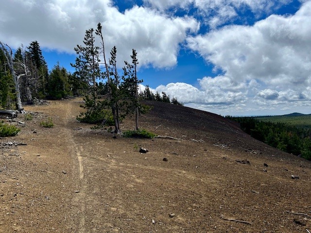
After passing small Twin Lakes and the junction with the Lava Lakes Trail, the hike passes through more woods and open areas until the final push up Maxwell Butte starts. The trail steepens and switchbacks and as hikers gain elevation, the views towards North and Middle Sister, The Husband, the Wife and then Broken Top become visible. The topography of Hogg Rock, Hoodoo and Hayrick Butte become very evident as hikers climb. However, it isn't until the peak of Maxwell Butte is reached before the stunning views of Three Fingered Jack become seen. Three Fingered Jack's western flank fills the view from the top of Maxwell Butte. Turning slightly west, the views toward Mt. Jefferson, Mt. Hood and the multitude of small and larger lakes in this section of the Willamette National Forest and Jefferson Wilderness were obvious, as were the results of many fires experienced in Central Oregon over the past few years. All in all, the hike to the top of Maxwell Butte is slightly over 10 miles with 2500 feet of elevation gain.
 |
 |
 |
 |
July
3
3
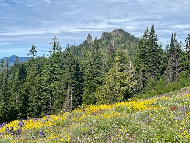
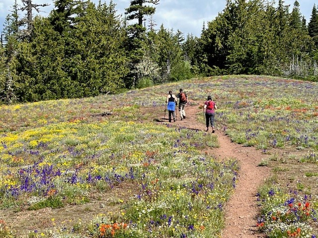
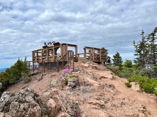
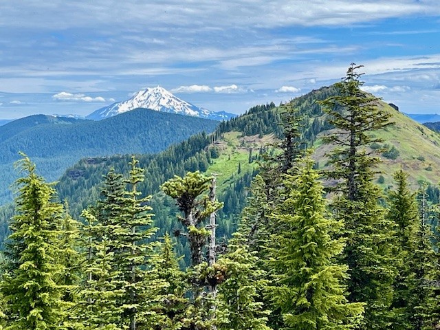
The Return to Iron Mountain 2024
 |
 |
 |
 |
 |
 |
 |
 |
 |
 |
June
24
24
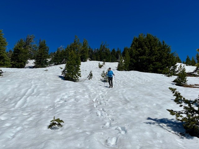
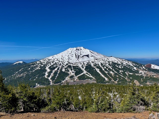
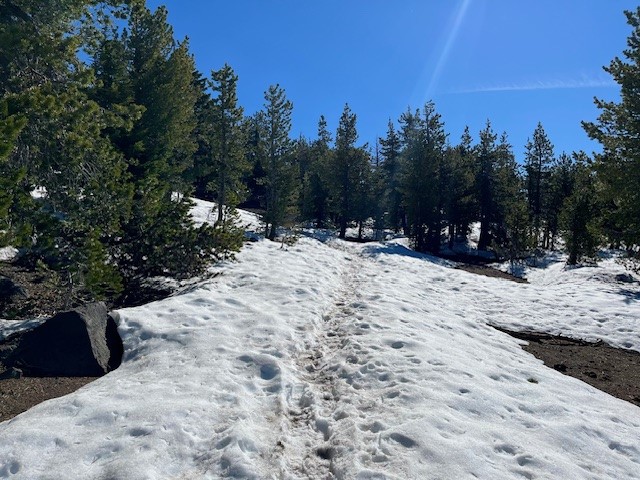
Hike Tumalo Mountain for Stunning Cascade Mountain Views
The Hike to Tumalo Mountain Still Has Snow 6-22-24
After a winter which had good snowfall, hiking into the high Cascades has been delayed due to the snow accumulation. However, the warm days experienced over the past week have aided snow melt. Last Saturday, June 22, 2024, enough snow had melted on Tumalo Mountain to enable hikers to walk the 1450 feet of elevation gain in two miles from the trailhead to the top. It appeared as if half the time the trail was covered by snow, but it was fairly easy to follow the route until the last 1/2 mile; GPS helped navigate this as did microspikes over ice.The hike up Tumalo Mountain is only 2 miles, but the views from the top toward South and Middle Sister, Broken Top, and Mt Bachelor can be spectacular. For those who take the hike early in the day, often the only people at the top are those in your group. Tumalo Mountain is a great way to begin the summer hiking in the Cascades.
 |
 |
 |
 |
June
20
20
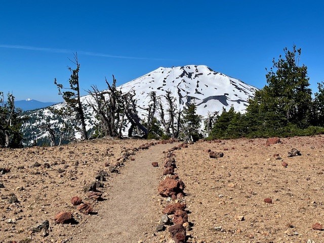
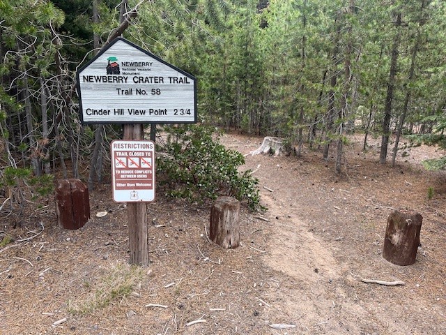
Cinder Hill in Newberry Crater National Monument is a Great Early Hike
Newberry Crater National Monument is Hikeable Now
While waiting for the snow to melt from the higher elevations of the Cascade Mountains, people looking for a Central Oregon hike with mountain views can consider Newberry Crater National Monument. Besides the well-known Paulina Falls, Obsidian Trail, the hike to Paulina Peak, and the various treks around both Paulina and East Lake, there is the relatively little known hike starting at the Cinder Hill campground at the end of the road by East Lake up to the Crater Rim and then to the Cinder Hill viewpoint. Although not the longest hike, there is close to 1000 feet elevation gain over two miles and then the relatively easy 3/4 mile hike along the Crater Rim trail to the view point. The hike from the campground to the rim is not difficult due to multiple switch backs and a gradual incline. The trail is well maintained and at the rim hikers may have to compete with people on mountain bikes to reach the view point.On June 15, 2024, the weather was cool with the temperature in the thirties at 9 am. The hike to the rim had some light snow as well as older snow patches left over from winter to traverse. At the view point, although very beautiful with views of East Lake, Paulina Peak and Paulina Lake, the wind was blowing and the wind chill was well below freezing. Hikers didn't last long admiring the setting.
 |
 |
 |
 |
June
13
13
Bend Premier Real Estate | June 2024 Newsletter
What's in the June 2024 Bend Premier Newsletter?
- What are the Puzzling Trends for Bend Home Sales?
- Raspberry and White Chocolate Muffins
- 10 Ways to Prepare Your Home for Summer
- The Road to Paulina Peak in Newberry Crater is Open for Hikers
- The Wealth Building Power of Home Ownership
Privacy Policy / DMCA Notice / ADA Accessibility
This site is hosted, designed and copyright
© 1994 - 2026 by
Delta Media Group, Inc. -- Patent Pending --