

Posts with tag 'Sisters'
Subscribe and receive email notifications of new blog posts.
 RSS Feed
14
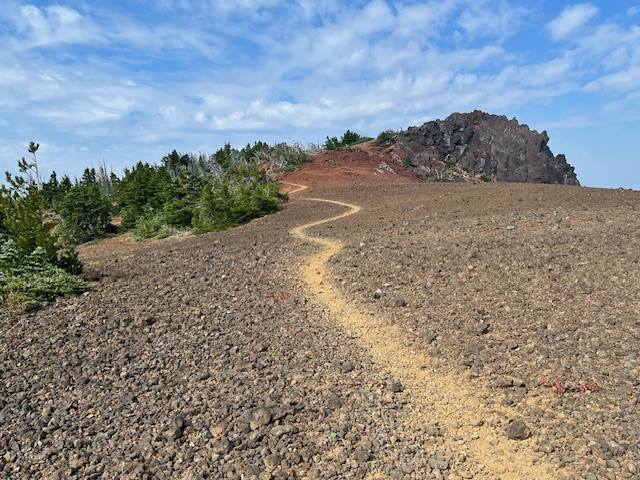
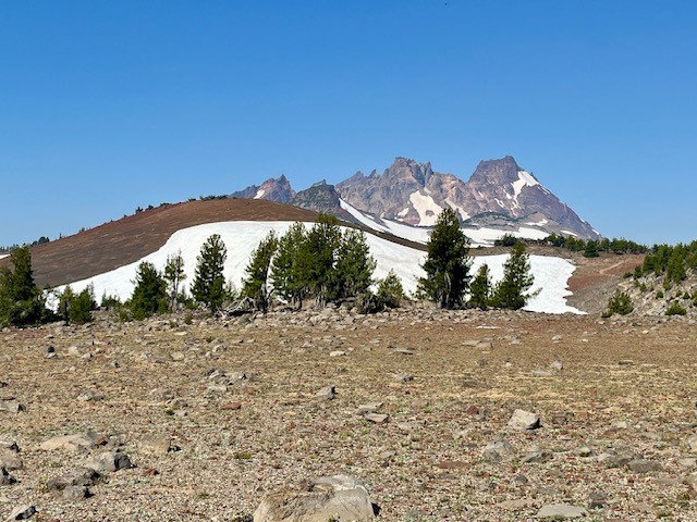
Black Crater is More About the Destination Than the Journey
Black Crater Trailhead is Located off McKenzie Hwy 242
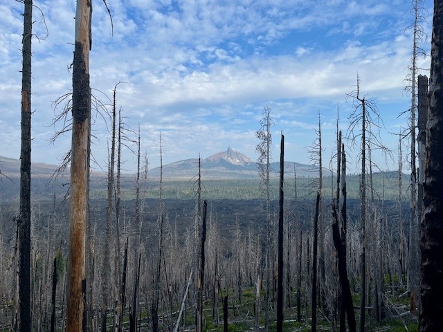
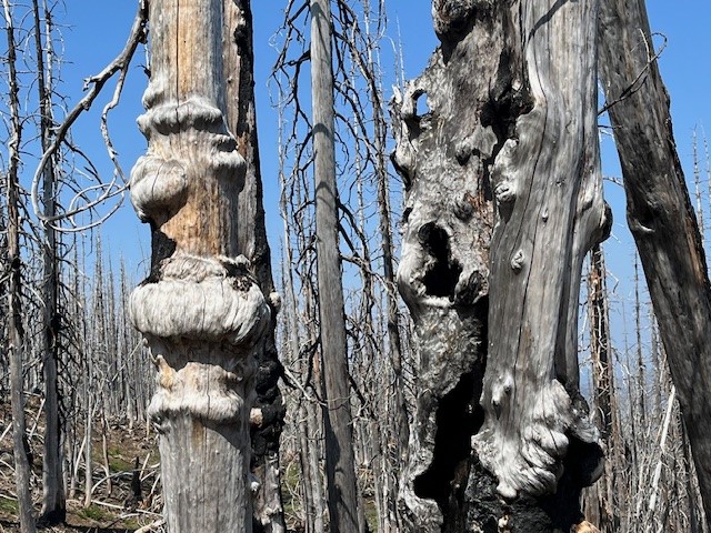
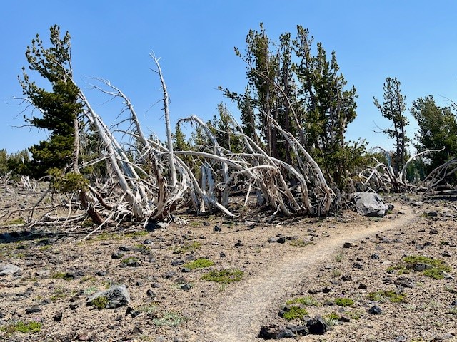
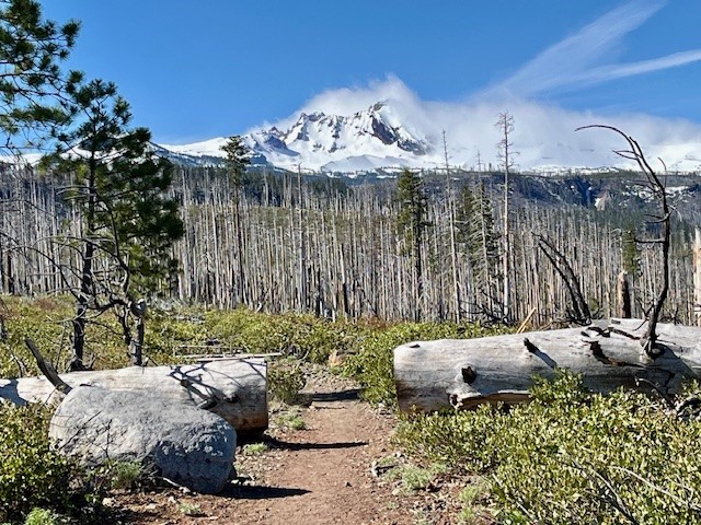
For those wanting a relatively short hike which provides for a lot of elevation gain, Black Crater is one of the best. Located off McKenzie Hwy 242, the hike is limited to the summer season when McKenzie Hwy opens each year. Unfortunately, the 2017 Milli fire burned a lot of the forest on McKenzie Hwy, and the lower slopes of Black Crater were impacted. In the seven years since the Milli fire, manzanita, certain grasses, some wildflowers, and young trees have begun to grow in the dead landscape, but it will take decades until the cinder cone is entirely forested again. The one advantage of the burned forest is the views toward Mt. Washington are far more visible in the lower elevations than they would have been eight years ago.
 |
 |
 |
 |
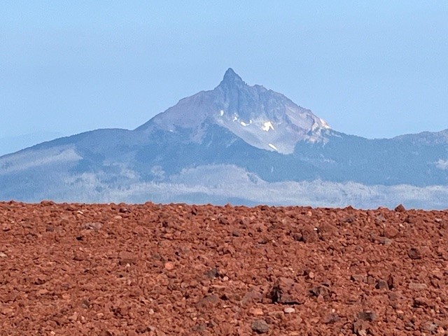
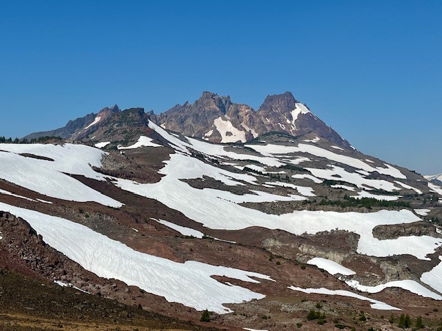
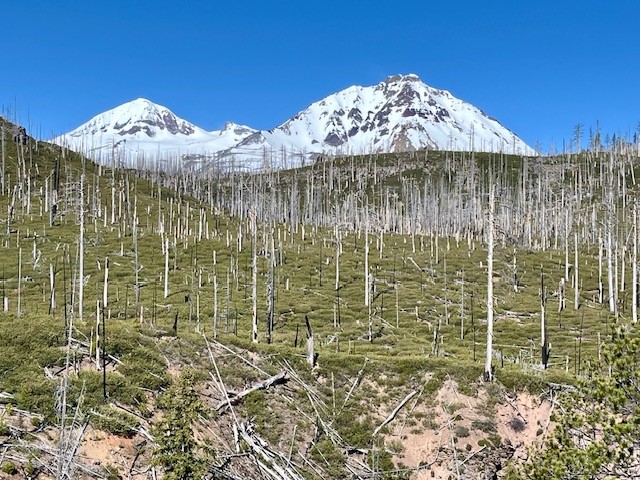
Roughly two and a half miles into the hike, the burned forest is left and the steep path zigzags through mixed forest and cinder fields. And at three and a half miles, hikers reach the top. The views on a clear day towards The Three Sisters, Broken Top, Mt Jefferson, Mt Washington, and all the hills in McKenzie Pass are fabulous. Plus hikers have the satisfaction of having climbed over 2300 feet to reach the top. The hike down goes faster than the up and many can complete the entire hike, without really pushing, in a little over three hours.
 |
 |
13
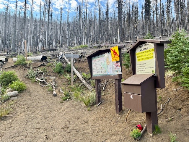
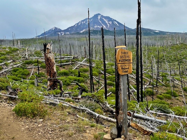
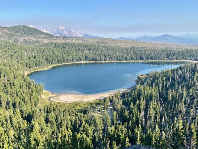
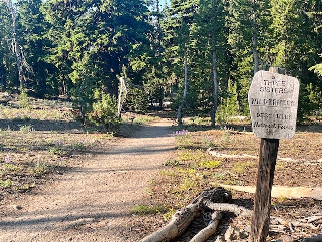
Few Hike to Camp Lake - But it is Worth it!
Camp Lake is at the Base of South Sister
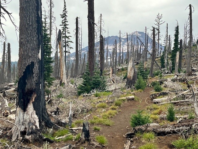
Although many will hike to Green Lakes and enjoy the experience of the lakes in the valley between South Sister and Broken Top, relatively few hike to Camp Lake and see South Sister so close from the north. The hike to Camp Lake (Pole Creek trailhead just outside of Sisters) takes you through several miles of burned forest before hikers enter living forest, so it can be hot and dusty in the summer. However, once hikers reach unburned trees, the hike becomes more pleasant. In recent years, the fallen trees of the burned forest have been cleared from the path, so scrambling over, under and around fallen logs was not an issue in 2024.
On August 3, 2024, the air in Central Oregon was better than it had been earlier in the week (many Oregon forest fires have impacted air quality), so the hike to Camp Lake was relatively clear. Views of North and Middle Sister stood out among the dead forest, but it was also interesting to see the new growth in acres of manzanita, grasses, some wildflowers, and young trees.
 |
 |
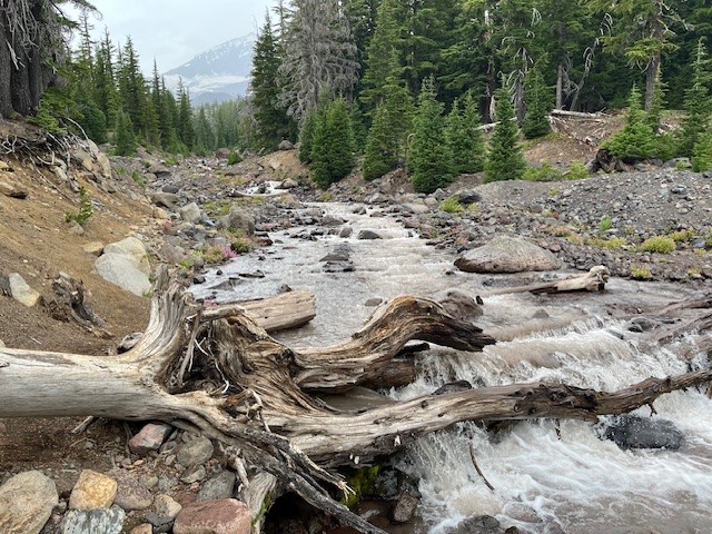
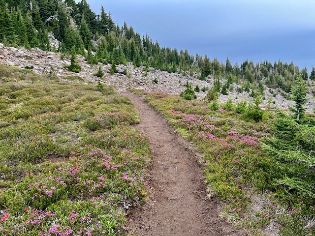
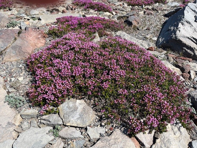
Tackling the creek (the North Fork of Whychus) can be challenging. In 2024, the natural log bridge which had provided a way across was broken and covered with water. Hikers need to walk upstream to find a safe place to step across via rocks in order to access the path on the other side of the creek. Past the creek, the hike climbs into new forested and alpine areas, some covered with wildflowers.
 |
 |
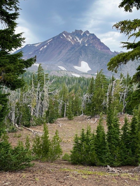 Throughout the hike, the views towards North, Middle and South Sister tower over the landscape and seeing them close is fascinating. Being able to pick out glaciers and streams and evidence of avalanches - along with ski tracks down snowfields from adventurous daredevils, can create a lot of conversation and wonder.
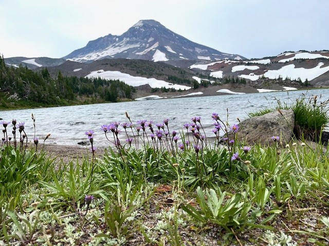
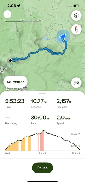
Arriving at Camp Lake in August, 2024, the weather was windy and cooler than in past years. Many who come this distance will camp overnight, exploring nearby Chambers Lake or other trails in the area. Some have been observed climbing Middle Sister as well from the lake. For those who wish to return in a day, after a rest at Camp Lake, the hike back to the Pole Creek Trailhead goes fairly fast as it is mostly downhill. Doing the hike in a day will result in 15 miles and around 2150 feet in elevation gain.
26
Hike Tam McArthur Rim to Broken Top For the Views and Experience
Besides the lake, many will take the 5.3 mile round trip hike (permit required) above the lake to Tam McArthur Rim, gaining over 1200 feet in elevation to reach the rim. Typically the views from this spot are clear from Broken Top and the Three Sisters all the way to Mt. Hood. However, in recent years summer forest fires have added haze and smoke often obstructing the views.
 |
 |
On July 20, 2024, the day started with a slight haze but by the end of the day, the smoke from forest fires settled into the area. However, the hike to Tam McArthur Rim was uneventful with just a handful of people also taking the same trek.
 |
 |
 |
 |
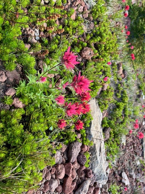
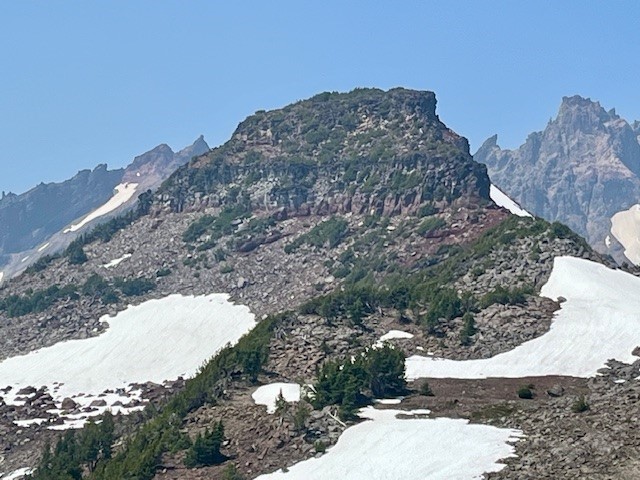
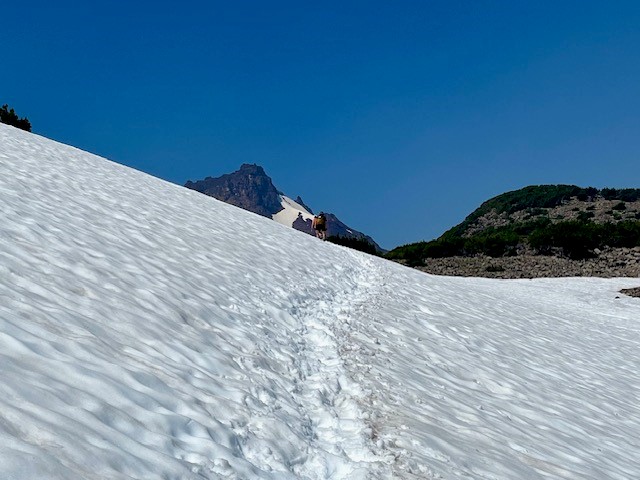
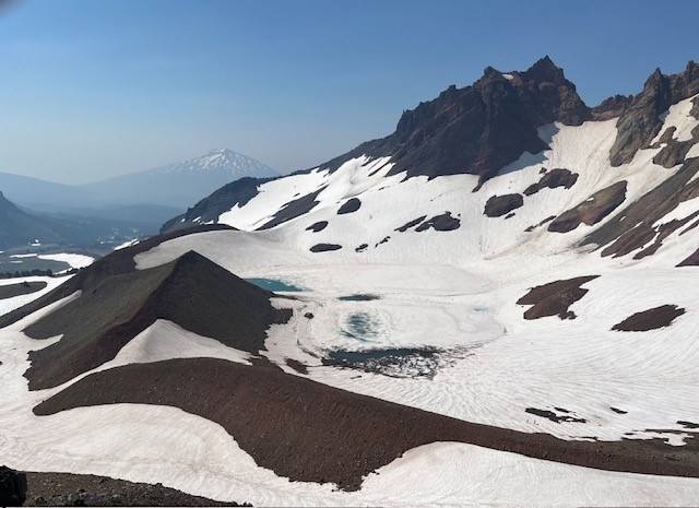
Past Tam McArthur Rim, the unmaintained trail to Broken Hand and Broken Top had abundant wildflowers for this alpine area as well as heavier snow patches than experienced in past years. The approach to Broken Hand involves scrambling over rocks and climbing several cinder ridges before reaching this rugged, rocky prominence. To pass it this July involved either detouring around the rocky base, hiking over snow fields, or trekking directly over snow on Broken Hand's westside. Either way people needed to be careful to avoid falling and sliding down the snowy hill. The majority of people appeared to be going directly over the snowy side of Broken Hand.
 |
 |
Past Broken Hand, there is a hill to climb to reach a fabulous view point. From here, the cragged top and colorful flanks of Broken Top are very visible (along with ski tracks from recent, ambitious past visitors who must have either rope climbed to the top of Broken Top and rappelled down or else made their was up the very steep side of the mountain to the top of the snow patch and skied down to the lake) as well as snow and ice covered No Name Lake. Besides Broken Top, the Three Sisters are very big and impressive from this view point and Mt. Bachelor and Tumalo Mountain visible in the hazy distance. The hike back to the trail head goes fairly fast as it is mostly downhill. All in all, the entire hike is under eleven miles and about 2150 feet of elevation gain.
 |
 |
15
Central Oregon Real Estate Market Trends - 2nd Quarter 2024
Central Oregon Market Trends 2nd Quarter 2024
The Central Oregon real estate 2024 market trends for most of the major urban areas continue to reflect a seller's market in 2nd quarter, although that has changed in La Pine where inventory levels at 7.4 months reflect a buyer's market; Powell Butte and Madras are in a balanced market at 6 months. Although still in a seller's market, inventory is at a level in Bend that hasn't been seen since July, 2015 when the average home price was $391,000 and mortgage interest rates were at 4%.* With more inventory, days on market have also ticked up, but well priced homes can still sell quickly and multiple offers can happen. Bend, Redmond and Sunriver are showing strong upward trends in all categories (the only exception for Bend is the number of homes sold) with home prices, listings, inventory levels and days on market all rising. As we move into 3rd quarter, we expect mortgage interest rates may drop, which could enable more home buyers to afford a Central Oregon home.30
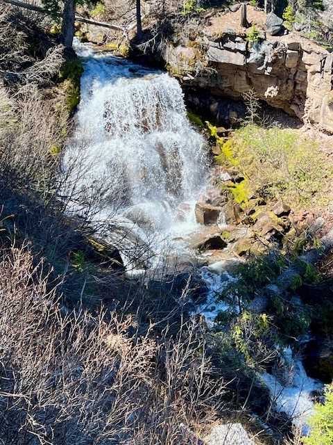
Chush Falls is a Fun Hike Just Outside Sisters Oregon
Chush Falls Is Snow Free
One of the earliest spring snow free hikes in Central Oregon's forests is the hike to Chush Falls. The trailhead is located off the road to Three Creeks Lake outside of Sisters several miles down a gravel road and then a short trek up a narrow dirt and rock road. The parking area is small so people wanting to hike the relatively short 2.2 miles to lower Chush Falls should plan on arriving early to get a parking space.
The trail starts in burned forest - the result of the 2017 Milli Fire. However, unlike the experience with earlier hikes, almost all of the burned trees from this fire which have fallen across the path have been cleared which makes the trek to Lower Chush Falls fairly quick. One result of the fire are the views of North/Middle Sister and Broken Top are more unobstructed. And the new young trees are getting taller and starting to be seen through the manzanita and snowbrush.
 |
|
For those who really want to see Lower Chush Falls, there is a steep scramble down the hillside to the base of the falls; the viewpoint at the top is disappointing with tall trees and vegetation obstructing views. However, for those who can tackle the steep hillside, the views of the falls from the base are wonderful.
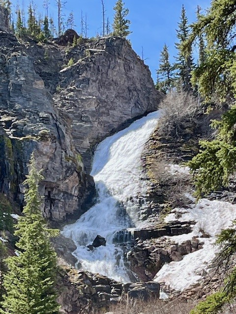
After climbing back up to the viewpoint, hikers can elect to return to the trailhead or continue on to Upper Chush Falls past smaller Cascades Waterfall. This path has not been cleared of fallen trees, so it is much slower to hike over, under and around the tree trunks. However, for those who make it to the trail's end, it is surprising to see the 200 foot waterfall; Lower Chush Falls is 50 feet. The vegetation is thick at the base of Upper Chush Falls with the canyon Whychus Creek flows through steep so it is challenging to really get a great view. The easiest access for photos is up the hillside above the creek over an unsteady rockfall. All in all, for those who make it to Upper Chush Falls, the total hike is 6.5 miles with 961 feet of elevation gain.
 |
 |
Privacy Policy / DMCA Notice / ADA Accessibility