

Posts with tag 'Why We Love Central Oregon'
Subscribe and receive email notifications of new blog posts.
 RSS Feed
13
Bend Premier Real Estate | June 2024 Newsletter
What's in the June 2024 Bend Premier Newsletter?
- What are the Puzzling Trends for Bend Home Sales?
- Raspberry and White Chocolate Muffins
- 10 Ways to Prepare Your Home for Summer
- The Road to Paulina Peak in Newberry Crater is Open for Hikers
- The Wealth Building Power of Home Ownership
5
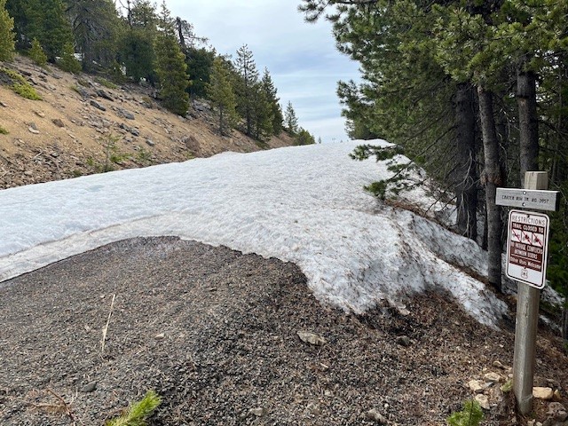
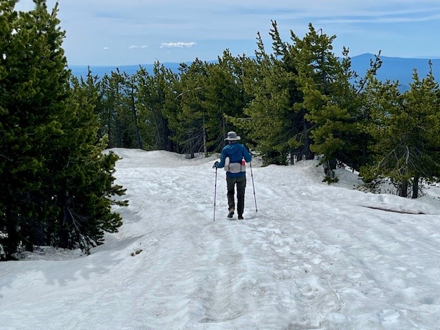
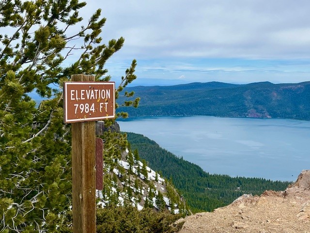
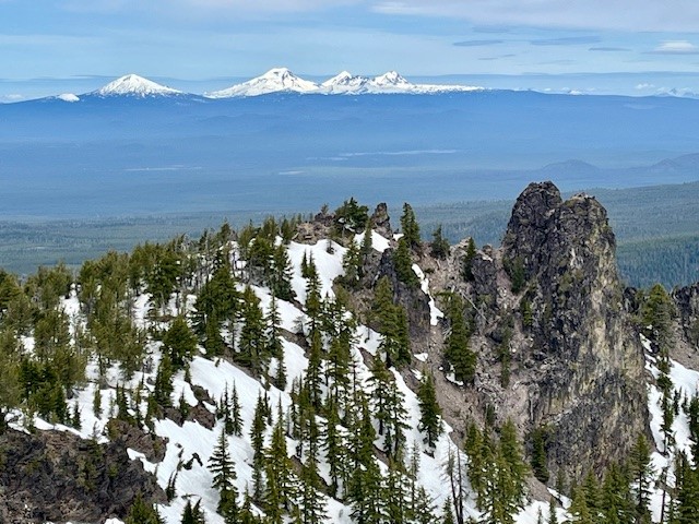
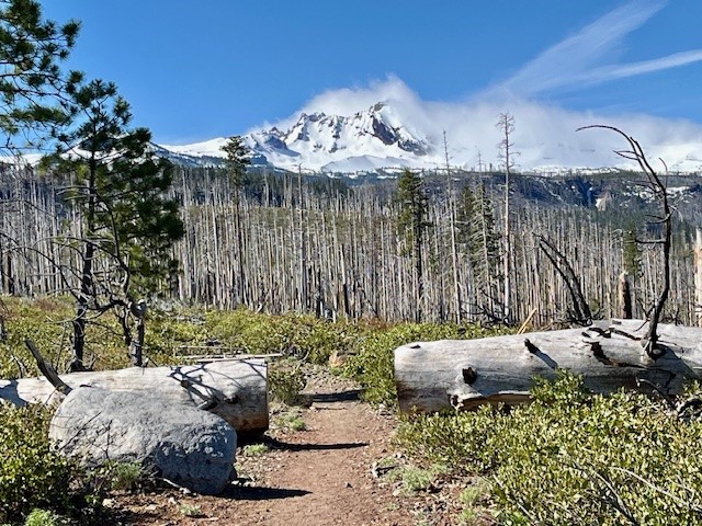
The Road to Paulina Peak in Newberry Crater is Open for Hikers Spring 2024
The Paulina Peak Road Has Snow But it is Melting Fast
Reports about the trail to the top of Paulina Peak in Newberry Crater National Monument on June 1, 2024 stated that the last mile had a lot of snow. Rather than navigate through this and the abrupt steep drop off the last mile of the trail, hikers could elect to walk the road up to the peak. This road was not yet open for vehicles and had snow patches in the shady areas, but was very much passable by hikers. The last 1/2 mile to the peak on the road had three feet of compacted snow, but with the use of trekking poles, it was easily traversed. The views of the snow capped Cascades and Paulina Lake were splendid from the top as were eastern views toward Fort Rock and the Obsidian Flow. Hiking the road results in 1600 feet of elevation gain to the peak which is just under 8000 feet above sea level, but over a more gradual grade than the trail, making for a longer hike but more easily done. All in all, the total hike by the road is just under 8 miles up and back from the gate off the main road through the monument.
 |
 |
 |
 |
30
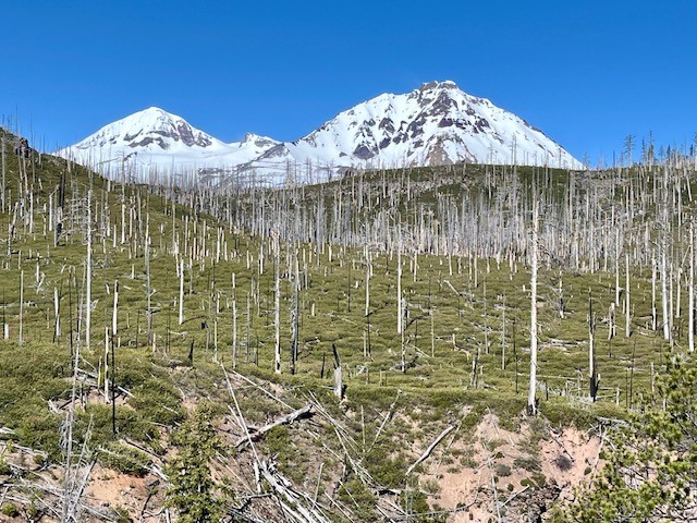
Chush Falls is a Fun Hike Just Outside Sisters Oregon
Chush Falls Is Snow Free
One of the earliest spring snow free hikes in Central Oregon's forests is the hike to Chush Falls. The trailhead is located off the road to Three Creeks Lake outside of Sisters several miles down a gravel road and then a short trek up a narrow dirt and rock road. The parking area is small so people wanting to hike the relatively short 2.2 miles to lower Chush Falls should plan on arriving early to get a parking space.
The trail starts in burned forest - the result of the 2017 Milli Fire. However, unlike the experience with earlier hikes, almost all of the burned trees from this fire which have fallen across the path have been cleared which makes the trek to Lower Chush Falls fairly quick. One result of the fire are the views of North/Middle Sister and Broken Top are more unobstructed. And the new young trees are getting taller and starting to be seen through the manzanita and snowbrush.
 |
|
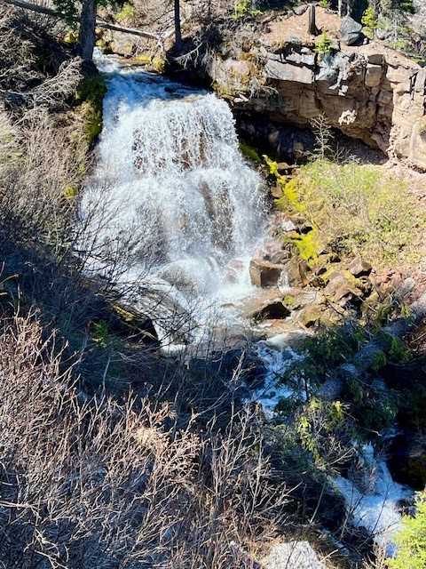
For those who really want to see Lower Chush Falls, there is a steep scramble down the hillside to the base of the falls; the viewpoint at the top is disappointing with tall trees and vegetation obstructing views. However, for those who can tackle the steep hillside, the views of the falls from the base are wonderful.
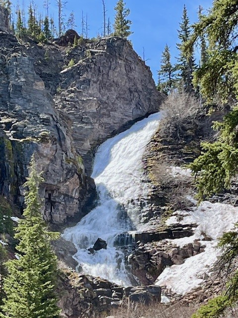
After climbing back up to the viewpoint, hikers can elect to return to the trailhead or continue on to Upper Chush Falls past smaller Cascades Waterfall. This path has not been cleared of fallen trees, so it is much slower to hike over, under and around the tree trunks. However, for those who make it to the trail's end, it is surprising to see the 200 foot waterfall; Lower Chush Falls is 50 feet. The vegetation is thick at the base of Upper Chush Falls with the canyon Whychus Creek flows through steep so it is challenging to really get a great view. The easiest access for photos is up the hillside above the creek over an unsteady rockfall. All in all, for those who make it to Upper Chush Falls, the total hike is 6.5 miles with 961 feet of elevation gain.
 |
 |
21
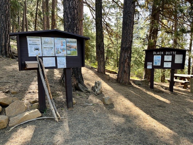
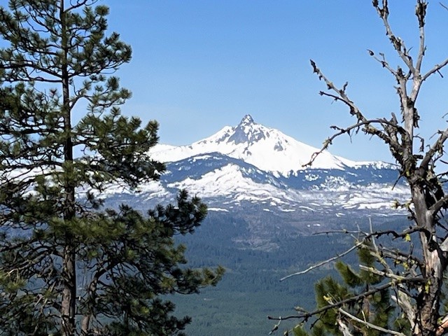
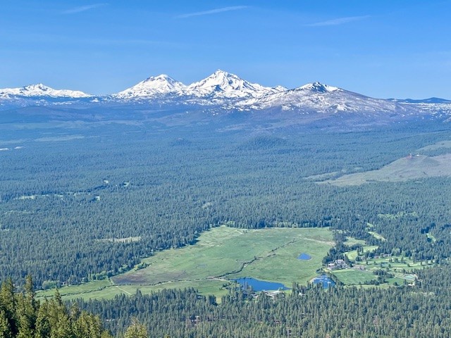
The Trail is Open to the Top of Black Butte
Black Butte Trail is Short but Steep
The trail to the top of Black Butte starts part way up the butte after a drive on a fairly well maintained dirt and gravel road followed by a poorly maintained dirt and rock road. Once you reach the trailhead (complete with stocked toilets), the two mile hike to the top of the butte can be accomplished fairly quickly. Hikers gain over 1500 feet in the two miles, but the Cascade views from Broken Top to Mt Adams can be spectacular on a clear day.
There is limited parking at the Black Butte Trailhead (forest pass required) so hikers are recommended to arrive early to get a spot and to avoid crowds. The hike is very popular with visitors to Black Butte Ranch and and Camp Sherman as well as local year-round residents.
 |
 |
 |
 |
23
20204 Bend Oregon Concerts Scheduled
Hayden Homes Amphitheater in Bend Oregon
Nestled in the heart of Bend's Old Mill District along side the Deschutes River, Hayden Homes Amphitheater stands as a testament to the harmony between nature and music. With its picturesque surroundings and state-of-the-art facilities, it has become a beacon for music enthusiasts and performers alike.
Privacy Policy / DMCA Notice / ADA Accessibility